 |
|
Location & QuickFacts
| FAA Information Effective: | 2008-09-25 |
| Airport Identifier: | TX72 |
| Airport Status: | Operational |
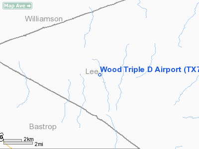
| Longitude/Latitude: | 097-11-40.9650W/30-22-44.7500N
-97.194713/30.379097 (Estimated) |
| Elevation: | 505 ft / 153.92 m (Estimated) |
| Land: | 40 acres |
| From nearest city: | 15 nautical miles E of Elgin, TX |
| Location: | Lee County, TX |
| Magnetic Variation: | 07E (1985) |
Owner & Manager
| Ownership: | Privately owned |
| Owner: | Dale Wood |
| Address: | Po Box 426
Mc Dade, TX 78650 |
| Phone number: | 512-273-2642 |
| Address: |
|
Airport Operations and Facilities
| Airport Use: | Private
PERSONAL USE. |
| Wind indicator: | Yes |
| Segmented Circle: | No |
| Control Tower: | No |
| Sectional chart: | San Antonio |
| Region: | ASW - Southwest |
| Boundary ARTCC: | ZHU - Houston |
| Tie-in FSS: | SJT - San Angelo |
| FSS Toll Free: | 1-800-WX-BRIEF |
Runway Information
Runway 09/27
| Dimension: | 1685 x 30 ft / 513.6 x 9.1 m |
| Surface: | TURF, |
| |
Runway 09 |
Runway 27 |
| Traffic Pattern: | Left | Left |
| Obstruction: | 25 ft trees, 50.0 ft from runway | 25 ft trees, 50.0 ft from runway |
|
Runway 17/35
| Dimension: | 1750 x 30 ft / 533.4 x 9.1 m |
| Surface: | TURF, |
| |
Runway 17 |
Runway 35 |
| Traffic Pattern: | Left | Left |
| Obstruction: | 25 ft trees, 50.0 ft from runway | 25 ft trees, 50.0 ft from runway |
|
Radio Navigation Aids
| ID |
Type |
Name |
Ch |
Freq |
Var |
Dist |
| GYB | NDB | Lee County | | 385.00 | 07E | 16.9 nm |
| GUO | NDB | Georgetown | | 332.00 | 06E | 31.1 nm |
| BNH | NDB | Brenham | | 362.00 | 06E | 43.6 nm |
| IL | NDB | Iresh | | 278.00 | 07E | 47.0 nm |
| CWK | VORTAC | Centex | 075X | 112.80 | 06E | 17.4 nm |
| IDU | VORTAC | Industry | 039X | 110.20 | 08E | 41.6 nm |
| CLL | VORTAC | College Station | 080X | 113.30 | 08E | 42.3 nm |
Images and information placed above are from
http://www.airport-data.com/airport/TX72/
We thank them for the data!
| General Info
|
| Country |
United States
|
| State |
TEXAS
|
| FAA ID |
TX72
|
| Latitude |
30-22-44.750N
|
| Longitude |
097-11-40.965W
|
| Elevation |
505 feet
|
| Near City |
ELGIN
|
We don't guarantee the information is fresh and accurate. The data may
be wrong or outdated.
For more up-to-date information please refer to other sources.
|
|


