 |
|
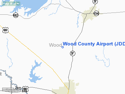
Location & QuickFacts
| FAA Information Effective: | 2008-09-25 |
| Airport Identifier: | JDD |
| Airport Status: | Operational |
| Longitude/Latitude: | 095-29-47.3100W/32-44-31.9300N
-95.496475/32.742203 (Estimated) |
| Elevation: | 434 ft / 132.28 m (Surveyed) |
| Land: | 106 acres |
| From nearest city: | 5 nautical miles N of Mineola/quitman, TX |
| Location: | Wood County, TX |
| Magnetic Variation: | 06E (1985) |
Owner & Manager
| Ownership: | Publicly owned |
| Owner: | Wood County |
| Address: | Wood County Courthouse
Quitman, TX 75783 |
| Phone number: | 903-763-2716 |
| Manager: | Wayne Collins |
| Address: | 311 County Road 2355
Mineola, TX 75773 |
| Phone number: | 903-768-2611 |
Airport Operations and Facilities
| Airport Use: | Open to public |
| Wind indicator: | Yes |
| Segmented Circle: | Yes |
| Control Tower: | No |
| Lighting Schedule: | DUSK-DAWN
MIRL RY 18/36 PRESET LOW INTST DUSK-DAWN; TO INCR INTST ACTVT - CTAF. |
| Beacon Color: | Clear-Green (lighted land airport) |
| Sectional chart: | Dallas-ft Worth |
| Region: | ASW - Southwest |
| Boundary ARTCC: | ZFW - Fort Worth |
| Tie-in FSS: | FTW - Fort Worth |
| FSS Phone: | 817-541-3474 |
| FSS Toll Free: | 1-800-WX-BRIEF |
| NOTAMs Facility: | JDD (NOTAM-d service avaliable) |
Airport Communications
| CTAF: | 122.800 |
| Unicom: | 122.800 |
Airport Services
| Fuel available: | 100LLA
SELF SERVE FUEL AVAILABLE 24 HRS. |
| Airframe Repair: | MAJOR |
| Power Plant Repair: | MAJOR |
Runway Information
Runway 18/36
| Dimension: | 4001 x 60 ft / 1219.5 x 18.3 m |
| Surface: | ASPH, Fair Condition |
| Weight Limit: | Single wheel: 12500 lbs. |
| Edge Lights: | Medium |
| |
Runway 18 |
Runway 36 |
| Longitude: | 095-29-46.4380W | 095-29-48.1790W |
| Latitude: | 32-44-51.7050N | 32-44-12.1450N |
| Elevation: | 406.00 ft | 433.00 ft |
| Alignment: | 127 | 2 |
| Traffic Pattern: | Left | Left |
| Markings: | Non-precision instrument, Good Condition | Non-precision instrument, Good Condition |
| Crossing Height: | 30.00 ft | 0.00 ft |
| VASI: | 2-light PAPI on left side | |
| Visual Glide Angle: | 3.00° | 0.00° |
| Obstruction: | 58 ft trees, 1653.0 ft from runway, 25:1 slope to clear | 78 ft trees, 2174.0 ft from runway, 25:1 slope to clear |
|
Radio Navigation Aids
| ID |
Type |
Name |
Ch |
Freq |
Var |
Dist |
| TY | NDB | Tyler | | 320.00 | 06E | 19.7 nm |
| ABG | NDB | Ambassador | | 404.00 | 07E | 21.6 nm |
| SYW | NDB | Cash | | 428.00 | 05E | 32.2 nm |
| AVZ | NDB | Travis | | 260.00 | 06E | 38.1 nm |
| AHX | NDB | Athens | | 269.00 | 06E | 38.9 nm |
| LST | NDB | Lone Star | | 305.00 | 05E | 39.6 nm |
| MII | NDB | Caddo Mills | | 316.00 | 06E | 42.0 nm |
| HNO | NDB | Henderson | | 371.00 | 06E | 46.4 nm |
| CSZ | NDB | Crossroads | | 215.00 | 08E | 47.0 nm |
| LIQ | NDB | Lochridge Ranch | | 335.00 | 09E | 49.7 nm |
| MJF | TACAN | Arvilla | 033X | | 05E | 34.5 nm |
| UIM | VOR/DME | Quitman | 087X | 114.00 | 08E | 10.6 nm |
| TYR | VOR/DME | Tyler | 089X | 114.20 | 06E | 23.7 nm |
| SLR | VOR/DME | Sulphur Springs | 027X | 109.00 | 08E | 27.5 nm |
| FZT | VOR/DME | Frankston | 051X | 111.40 | 06E | 40.2 nm |
| PRX | VOR/DME | Paris | 083X | 113.60 | 07E | 48.2 nm |
| GGG | VORTAC | Gregg County | 070X | 112.30 | 07E | 42.4 nm |
| CQY | VORTAC | Cedar Creek | 095X | 114.80 | 06E | 49.6 nm |
Remarks
- BLUE TWY CNTRLN REFLECTORS.
Images and information placed above are from
http://www.airport-data.com/airport/JDD/
We thank them for the data!
| General Info
|
| Country |
United States
|
| State |
TEXAS
|
| FAA ID |
JDD
|
| Latitude |
32.742203
32° 44' 31.93" N
|
| Longitude |
-95.496475
095° 29' 47.31" W
|
| Elevation |
434 feet
132 meters
|
| Magnetic Variation |
004° E (01/06)
|
| Beacon |
Yes
|
| Operating Agency |
U.S.CIVIL AIRPORT WHEREIN PERMIT COVERS USE BY TRANSIT MILITARY AIRCRAFT
|
| Daylight Saving Time |
Second Sunday in March at 0200 to first Sunday in November at 0200 local time (Exception Arizona and that portion of Indiana in the Eastern Time Zone)
|
We don't guarantee the information is fresh and accurate. The data may
be wrong or outdated.
For more up-to-date information please refer to other sources.
|
|


