 |
|
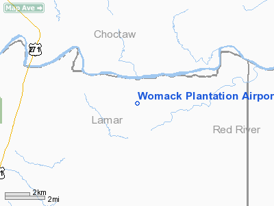
Womack Plantation Airport |
Location & QuickFacts
| FAA Information Effective: | 2008-09-25 |
| Airport Identifier: | 0TA8 |
| Airport Status: | Operational |
| Longitude/Latitude: | 095-24-25.8400W/33-50-55.3810N
-95.407178/33.848717 (Estimated) |
| Elevation: | 410 ft / 124.97 m (Estimated) |
| Land: | 0 acres |
| From nearest city: | 16 nautical miles NE of Paris, TX |
| Location: | Lamar County, TX |
| Magnetic Variation: | 06E (1985) |
Owner & Manager
| Ownership: | Privately owned |
| Owner: | Womack Farms |
| Address: | 53 Regents Park
Bedford, TX 76021 |
| Phone number: | 214-732-4808 |
| Manager: | M. Womack |
| Address: | Rt 6, Box 176a
Paris, TX 75460 |
| Phone number: | 817-268-4892 |
Airport Operations and Facilities
| Airport Use: | Private |
| Wind indicator: | No |
| Segmented Circle: | No |
| Control Tower: | No |
| Landing fee charge: | No |
| Sectional chart: | Dallas-ft Worth |
| Region: | ASW - Southwest |
| Boundary ARTCC: | ZFW - Fort Worth |
| Tie-in FSS: | FTW - Fort Worth |
| FSS on Airport: | No |
| FSS Phone: | 817-541-3474 |
| FSS Toll Free: | 1-800-WX-BRIEF |
Runway Information
Runway N/S
| Dimension: | 2680 x 45 ft / 816.9 x 13.7 m |
| Surface: | TURF, |
| |
Runway N |
Runway S |
| Traffic Pattern: | Left | Left |
| Obstruction: | | 75 ft trees, 1000.0 ft from runway |
|
Radio Navigation Aids
| ID |
Type |
Name |
Ch |
Freq |
Var |
Dist |
| HHW | NDB | Hugo | | 323.00 | 05E | 13.2 nm |
| AEE | NDB | Antlers | | 391.00 | 05E | 24.0 nm |
| IBO | NDB | Idabel | | 271.00 | 03E | 28.4 nm |
| HJM | NDB | Rayburn | | 415.00 | 06E | 40.9 nm |
| DUA | NDB | Durant | | 359.00 | 05E | 49.8 nm |
| PRX | VOR/DME | Paris | 083X | 113.60 | 07E | 18.5 nm |
| SLR | VOR/DME | Sulphur Springs | 027X | 109.00 | 08E | 39.7 nm |
| URH | VOR/DME | Texoma | 090X | 114.30 | 05E | 49.5 nm |
| BYP | VORTAC | Bonham | 093X | 114.60 | 06E | 45.4 nm |
Remarks
- CTN; LOW LEVEL MIL FLTS IN AREA OF ARPT.
- OWNER DESIRES ARPT BE CHARTED.
Images and information placed above are from
http://www.airport-data.com/airport/0TA8/
We thank them for the data!
| General Info
|
| Country |
United States
|
| State |
TEXAS
|
| FAA ID |
0TA8
|
| Latitude |
33-50-55.381N
|
| Longitude |
095-24-25.840W
|
| Elevation |
410 feet
|
| Near City |
PARIS
|
We don't guarantee the information is fresh and accurate. The data may
be wrong or outdated.
For more up-to-date information please refer to other sources.
|
|


