 |
|
Location & QuickFacts
| FAA Information Effective: | 2008-09-25 |
| Airport Identifier: | TE61 |
| Airport Status: | Operational |
| Longitude/Latitude: | 096-24-33.0000W/28-42-47.4000N
-96.409167/28.713167 (Estimated) |
| Elevation: | 14 ft / 4.27 m (Estimated) |
| Land: | 2 acres |
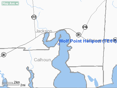
| From nearest city: | 5 nautical miles N of Olivia, TX |
| Location: | Calhoun County, TX |
| Magnetic Variation: | 06E (1995) |
Owner & Manager
| Ownership: | Privately owned |
| Owner: | Dianna Stanger |
| Address: | 1005 Shoreline Lane
Port Lavaca, TX 77979 |
| Phone number: | 361-893-5115 |
| Manager: | Dianna Stanger |
| Address: | 1005 Shoreline Lane
Port Lavaca, TX 77979 |
| Phone number: | 361-893-5115 |
Airport Operations and Facilities
| Airport Use: | Private |
| Segmented Circle: | No |
| Control Tower: | No |
| Sectional chart: | Houston |
| Region: | ASW - Southwest |
| Boundary ARTCC: | ZHU - Houston |
| Tie-in FSS: | CXO - Montgomery County |
| FSS Toll Free: | 1-800-WX-BRIEF |
Runway Information
Helipad H1
| Dimension: | 30 x 30 ft / 9.1 x 9.1 m |
| Surface: | CONC, |
| |
Runway H1 |
Runway |
| Traffic Pattern: | Left | Left |
|
Radio Navigation Aids
| ID |
Type |
Name |
Ch |
Freq |
Var |
Dist |
| PKV | NDB | Port Lavaca | | 515.00 | 05E | 14.8 nm |
| BYY | NDB | Bay City | | 344.00 | 06E | 32.9 nm |
| ARM | NDB | Wharton | | 245.00 | 06E | 35.2 nm |
| MNO | NDB | Mellon Ranch | | 375.00 | 06E | 49.5 nm |
| VCT | VOR/DME | Victoria | 027X | 109.00 | 06E | 32.0 nm |
| PSX | VORTAC | Palacios | 120X | 117.30 | 08E | 6.2 nm |
Images and information placed above are from
http://www.airport-data.com/airport/TE61/
We thank them for the data!
| General Info
|
| Country |
United States
|
| State |
TEXAS
|
| FAA ID |
TE61
|
| Latitude |
28-42-47.400N
|
| Longitude |
096-24-33.000W
|
| Elevation |
14 feet
|
| Near City |
OLIVIA
|
We don't guarantee the information is fresh and accurate. The data may
be wrong or outdated.
For more up-to-date information please refer to other sources.
|
|


