 |
|
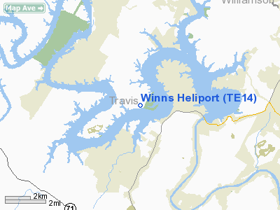
Location & QuickFacts
| FAA Information Effective: | 2008-09-25 |
| Airport Identifier: | TE14 |
| Airport Status: | Operational |
| Longitude/Latitude: | 097-57-36.0440W/30-24-04.7200N
-97.960012/30.401311 (Estimated) |
| Elevation: | 750 ft / 228.60 m (Estimated) |
| Land: | 0 acres |
| From nearest city: | 3 nautical miles SW of Jonestown, TX |
| Location: | Travis County, TX |
| Magnetic Variation: | 07E (1985) |
Owner & Manager
| Ownership: | Privately owned |
| Owner: | David L Winn |
| Address: | Route 2; Box 332w
Leander, TX 78641 |
| Phone number: | 512-267-3520 |
| Manager: | David L Winn |
| Address: | Route 2; Box 332w
Leander, TX 78641 |
| Phone number: | 512-267-3520 |
Airport Operations and Facilities
| Airport Use: | Private |
| Wind indicator: | Yes |
| Segmented Circle: | No |
| Control Tower: | No |
| Lighting Schedule: | PHONE REQ
FOR HELIPAD LGTS CALL 512-267-3520. |
| Sectional chart: | San Antonio |
| Region: | ASW - Southwest |
| Boundary ARTCC: | ZHU - Houston |
| Tie-in FSS: | SJT - San Angelo |
| FSS Toll Free: | 1-800-WX-BRIEF |
Runway Information
Helipad H1
| Dimension: | 30 x 30 ft / 9.1 x 9.1 m |
| Surface: | CONC, |
| |
Runway H1 |
Runway |
| Traffic Pattern: | Left | Left |
|
Radio Navigation Aids
| ID |
Type |
Name |
Ch |
Freq |
Var |
Dist |
| MFS | NDB | Horseshoe Bay Resort | | 403.00 | 07E | 21.9 nm |
| GUO | NDB | Georgetown | | 332.00 | 06E | 22.4 nm |
| BMQ | NDB | Burnet | | 341.00 | 07E | 24.9 nm |
| IL | NDB | Iresh | | 278.00 | 07E | 39.6 nm |
| HLR | NDB | Hood | | 347.00 | 07E | 45.6 nm |
| GR | NDB | Starn | | 323.00 | 07E | 46.3 nm |
| GRK | VOR/DME | Gray | 055X | 111.80 | 07E | 38.7 nm |
| CWK | VORTAC | Centex | 075X | 112.80 | 06E | 22.3 nm |
| STV | VORTAC | Stonewall | 085X | 113.80 | 08E | 40.4 nm |
| LZZ | VORTAC | Lampasas | 072X | 112.50 | 08E | 48.1 nm |
| LLO | VORTAC | Llano | 019X | 108.20 | 08E | 49.0 nm |
Images and information placed above are from
http://www.airport-data.com/airport/TE14/
We thank them for the data!
| General Info
|
| Country |
United States
|
| State |
TEXAS
|
| FAA ID |
TE14
|
| Latitude |
30-24-04.720N
|
| Longitude |
097-57-36.044W
|
| Elevation |
750 feet
|
| Near City |
JONESTOWN
|
We don't guarantee the information is fresh and accurate. The data may
be wrong or outdated.
For more up-to-date information please refer to other sources.
|
|


