 |
|
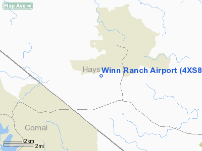
Location & QuickFacts
| FAA Information Effective: | 2008-09-25 |
| Airport Identifier: | 4XS8 |
| Airport Status: | Operational |
| Longitude/Latitude: | 098-07-01.0340W/29-58-00.7740N
-98.116954/29.966882 (Estimated) |
| Elevation: | 960 ft / 292.61 m (Estimated) |
| Land: | 0 acres |
| From nearest city: | 2 nautical miles SW of Wimberley, TX |
| Location: | Hays County, TX |
| Magnetic Variation: | 07E (1985) |
Owner & Manager
| Ownership: | Privately owned |
| Owner: | J Buck Winn Jr |
| Address: | Rt 1, Box 115
Wimberley, TX 78676 |
| Phone number: | 512-847-9305 |
| Manager: | Jim Winn |
| Address: | Po Box 1727
Wimberley, TX 78676 |
| Phone number: | 512-847-9305 |
Airport Operations and Facilities
| Airport Use: | Private |
| Wind indicator: | No |
| Segmented Circle: | No |
| Control Tower: | No |
| Landing fee charge: | No |
| Sectional chart: | San Antonio |
| Region: | ASW - Southwest |
| Boundary ARTCC: | ZHU - Houston |
| Tie-in FSS: | SJT - San Angelo |
| FSS on Airport: | No |
| FSS Toll Free: | 1-800-WX-BRIEF |
Airport Services
| Airframe Repair: | NONE |
| Power Plant Repair: | NONE |
Runway Information
Runway 12/30
| Dimension: | 2100 x 40 ft / 640.1 x 12.2 m |
| Surface: | TURF, |
| |
Runway 12 |
Runway 30 |
| Traffic Pattern: | Left | Left |
|
Radio Navigation Aids
| ID |
Type |
Name |
Ch |
Freq |
Var |
Dist |
| MFS | NDB | Horseshoe Bay Resort | | 403.00 | 07E | 35.7 nm |
| ER | NDB | Shein | | 263.00 | 08E | 46.6 nm |
| BMQ | NDB | Burnet | | 341.00 | 07E | 46.9 nm |
| GUO | NDB | Georgetown | | 332.00 | 06E | 48.7 nm |
| DHK | TACAN | Randolph | 036X | | 09E | 27.0 nm |
| KSY | TACAN | Kelly | 057X | | 07E | 42.2 nm |
| SSF | VOR | Stinson | | 108.40 | 09E | 45.9 nm |
| SAT | VORTAC | San Antonio | 115X | 116.80 | 08E | 26.4 nm |
| RND | VORTAC | Randolph | 70X | 112.30 | 09E | 28.3 nm |
| STV | VORTAC | Stonewall | 085X | 113.80 | 08E | 33.8 nm |
| CWK | VORTAC | Centex | 075X | 112.80 | 06E | 39.3 nm |
| SAT | VOT | San Antonio Intl | | 110.40 | | 31.9 nm |
Remarks
- MOUNTAINS SE.
- PREDATES THE ACT.
Images and information placed above are from
http://www.airport-data.com/airport/4XS8/
We thank them for the data!
| General Info
|
| Country |
United States
|
| State |
TEXAS
|
| FAA ID |
4XS8
|
| Latitude |
29-58-00.774N
|
| Longitude |
098-07-01.034W
|
| Elevation |
960 feet
|
| Near City |
WIMBERLEY
|
We don't guarantee the information is fresh and accurate. The data may
be wrong or outdated.
For more up-to-date information please refer to other sources.
|
|


