 |
|
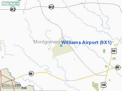
Location & QuickFacts
| FAA Information Effective: | 2008-09-25 |
| Airport Identifier: | 9X1 |
| Airport Status: | Operational |
| Longitude/Latitude: | 095-19-19.1600W/30-09-12.1500N
-95.321989/30.153375 (Estimated) |
| Elevation: | 122 ft / 37.19 m (Estimated) |
| Land: | 107 acres |
| From nearest city: | 6 nautical miles NW of Porter, TX |
| Location: | Montgomery County, TX |
| Magnetic Variation: | 06E (1985) |
Owner & Manager
| Ownership: | Privately owned |
| Owner: | Williams Airport Inc |
| Address: | Po Box 2390
Porter, TX 77365 |
| Phone number: | 281-572-1111 |
| Manager: | Katie Jarrett |
| Address: | Po Box 2390
Porter, TX 77365 |
| Phone number: | 281-572-1111 |
Airport Operations and Facilities
| Airport Use: | Open to public |
| Wind indicator: | Yes |
| Segmented Circle: | No |
| Control Tower: | No |
| Lighting Schedule: | DUSK-DAWN |
| Landing fee charge: | No |
| Sectional chart: | Houston |
| Region: | ASW - Southwest |
| Boundary ARTCC: | ZHU - Houston |
| Tie-in FSS: | CXO - Montgomery County |
| FSS on Airport: | No |
| FSS Toll Free: | 1-800-WX-BRIEF
FOR FP FILING CALL CXO FSS 1-800-992-7433. |
| NOTAMs Facility: | CXO (NOTAM-d service avaliable) |
Airport Communications
| CTAF: | 122.800 |
| Unicom: | 122.800 |
Airport Services
| Fuel available: | 100LL |
| Airframe Repair: | MAJOR |
| Power Plant Repair: | MAJOR |
Runway Information
Runway 17/35
| Dimension: | 3594 x 46 ft / 1095.5 x 14.0 m |
| Surface: | ASPH, Fair Condition |
| Edge Lights: | Low |
| |
Runway 17 |
Runway 35 |
| Traffic Pattern: | Left | Left |
| Obstruction: | 53 ft trees, 220.0 ft from runway, 75L/ ft right of centerline
+33 FT MKD PLINE 175 FT FM THLD 150 FT R & L OF CNTRLN; ROAD 190 FT FM THLD ACROSS APCH. | 35 ft trees, 200.0 ft from runway, 125 ft right of centerline
+20 FT TREES 105 FT FM THLD BOTH SIDES OF CENTERLINE. |
|
Radio Navigation Aids
| ID |
Type |
Name |
Ch |
Freq |
Var |
Dist |
| BVP | NDB | Nixin | | 326.00 | 05E | 11.1 nm |
| DWH | NDB | David Hooks | | 521.00 | 05E | 12.8 nm |
| EYQ | NDB | Weiser | | 286.00 | 06E | 21.2 nm |
| LYD | NDB | Lakeside | | 249.00 | 05E | 27.4 nm |
| JPA | NDB | Sanjac | | 347.00 | 05E | 32.0 nm |
| SGR | NDB | Hull | | 388.00 | 05E | 35.8 nm |
| UTS | NDB | Huntsville | | 308.00 | 06E | 38.0 nm |
| SYG | NDB | Sandy Point | | 402.00 | 05E | 39.9 nm |
| CBC | NDB | Anahuac | | 413.00 | 05E | 41.3 nm |
| EFD | TACAN | Ellington | 031X | | 05E | 34.0 nm |
| HUB | VOR/DME | Hobby | 118X | 117.10 | 05E | 30.0 nm |
| MHF | VOR/DME | Trinity | 083X | 113.60 | 07E | 47.2 nm |
| IAH | VORTAC | Humble | 113X | 116.60 | 05E | 11.9 nm |
| DAS | VORTAC | Daisetta | 116X | 116.90 | 05E | 35.2 nm |
| TNV | VORTAC | Navasota | 106X | 115.90 | 08E | 39.1 nm |
| HOU | VOT | Houston Wm P Hobby | | 108.40 | | 30.6 nm |
Remarks
- DEER ON & INVOF RY AT NGT.
- RY 17/35 UNMARKED.
- PRVDD TREES AT BOTH RWY ENDS ARE TOPPED/RMVD TO PRVD 20:1 APP OR THR DSPLCD.
Images and information placed above are from
http://www.airport-data.com/airport/9X1/
We thank them for the data!
| General Info
|
| Country |
United States
|
| State |
TEXAS
|
| FAA ID |
9X1
|
| Latitude |
30-09-12.150N
|
| Longitude |
095-19-19.160W
|
| Elevation |
122 feet
|
| Near City |
PORTER
|
We don't guarantee the information is fresh and accurate. The data may
be wrong or outdated.
For more up-to-date information please refer to other sources.
|
|


