 |
|
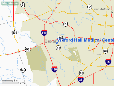
Wilford Hall Medical Center Heliport |
Location & QuickFacts
| FAA Information Effective: | 2008-09-25 |
| Airport Identifier: | 9TS5 |
| Airport Status: | Operational |
| Longitude/Latitude: | 098-37-25.0730W/29-23-48.8420N
-98.623631/29.396901 (Estimated) |
| Elevation: | 762 ft / 232.26 m (Estimated) |
| Land: | 0 acres |
| From nearest city: | 5 nautical miles SW of San Antonio, TX |
| Location: | Bexar County, TX |
| Magnetic Variation: | 07E (1986) |
Owner & Manager
| Ownership: | Air Force owned |
| Owner: | U.s. Air Force |
| Address: |
|
| Phone number: | 512-670-7171 |
| Manager: | David P. Pletcher, Maj |
| Address: | Wilford Hall Med Ctr/sglf
Lackland Afb, TX 78236-5300 |
Airport Operations and Facilities
| Airport Use: | Private
MEDICAL. |
| Wind indicator: | Yes |
| Segmented Circle: | No |
| Control Tower: | No |
| Lighting Schedule: | RDO-CTL
FOR PRIMETER LGTS KEY 126.2 - 5 TIMES. |
| Sectional chart: | San Antonio |
| Region: | ASW - Southwest |
| Boundary ARTCC: | ZHU - Houston |
| Tie-in FSS: | SJT - San Angelo |
| FSS on Airport: | No |
| FSS Toll Free: | 1-800-WX-BRIEF |
Runway Information
Helipad H1
| Dimension: | 100 x 100 ft / 30.5 x 30.5 m |
| Surface: | CONC, |
| |
Runway H1 |
Runway |
| Traffic Pattern: | Left | Left |
|
Radio Navigation Aids
| ID |
Type |
Name |
Ch |
Freq |
Var |
Dist |
| CVB | NDB | Castroville | | 338.00 | 08E | 12.2 nm |
| HHH | NDB | Devine | | 359.00 | 07E | 22.7 nm |
| PEZ | NDB | Pleasanton | | 275.00 | 07E | 27.1 nm |
| HMA | NDB | Hondo | | 329.00 | 08E | 28.8 nm |
| ER | NDB | Shein | | 263.00 | 08E | 37.1 nm |
| KSY | TACAN | Kelly | 057X | | 07E | 2.3 nm |
| DHK | TACAN | Randolph | 036X | | 09E | 20.4 nm |
| SSF | VOR | Stinson | | 108.40 | 09E | 12.6 nm |
| HDO | VOR/DME | Hondo | 31X | 109.40 | 08E | 29.2 nm |
| SAT | VORTAC | San Antonio | 115X | 116.80 | 08E | 17.1 nm |
| RND | VORTAC | Randolph | 70X | 112.30 | 09E | 19.2 nm |
| CSI | VORTAC | Center Point | 122X | 117.50 | 08E | 44.2 nm |
| STV | VORTAC | Stonewall | 085X | 113.80 | 08E | 48.9 nm |
| SAT | VOT | San Antonio Intl | | 110.40 | | 11.5 nm |
Remarks
- DO NOT OVERFLY HOSPITAL.
- CTC KELLY AFB ATCT PRIOR TO ENTERING KELLY ARPT TFC AREA; CTC KELLY PTD 20 MIN PRIOR TO LDG WITH ETA/AIREVAC/VIP INFO.
Images and information placed above are from
http://www.airport-data.com/airport/9TS5/
We thank them for the data!
| General Info
|
| Country |
United States
|
| State |
TEXAS
|
| FAA ID |
9TS5
|
| Latitude |
29-23-48.842N
|
| Longitude |
098-37-25.073W
|
| Elevation |
762 feet
|
| Near City |
SAN ANTONIO
|
We don't guarantee the information is fresh and accurate. The data may
be wrong or outdated.
For more up-to-date information please refer to other sources.
|
|


