 |
|
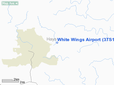
Location & QuickFacts
| FAA Information Effective: | 2008-09-25 |
| Airport Identifier: | 3TS1 |
| Airport Status: | Operational |
| Longitude/Latitude: | 098-02-25.8100W/30-00-40.9300N
-98.040503/30.011369 (Estimated) |
| Elevation: | 1083 ft / 330.10 m (Estimated) |
| Land: | 5 acres |
| From nearest city: | 4 nautical miles W of Wimberley, TX |
| Location: | Hays County, TX |
| Magnetic Variation: | 06E (1995) |
Owner & Manager
| Ownership: | Privately owned |
| Owner: | Tinna A. Kurri |
| Address: | 200 White Wings Road
Wimberley, TX 78676 |
| Address: |
|
Airport Operations and Facilities
| Airport Use: | Private |
| Segmented Circle: | No |
| Control Tower: | No |
| Sectional chart: | San Antonio |
| Region: | ASW - Southwest |
| Boundary ARTCC: | ZHU - Houston |
| Tie-in FSS: | SJT - San Angelo |
| FSS on Airport: | No |
| FSS Toll Free: | 1-800-WX-BRIEF |
Runway Information
Runway 02/20
| Dimension: | 3000 x 50 ft / 914.4 x 15.2 m |
| Surface: | ASPH, Fair Condition |
| |
Runway 02 |
Runway 20 |
| Traffic Pattern: | Left | Left |
| Obstruction: | 10 ft trees, 100.0 ft from runway | 5 ft trees, 150.0 ft from runway |
|
Radio Navigation Aids
| ID |
Type |
Name |
Ch |
Freq |
Var |
Dist |
| MFS | NDB | Horseshoe Bay Resort | | 403.00 | 07E | 34.9 nm |
| GUO | NDB | Georgetown | | 332.00 | 06E | 44.6 nm |
| BMQ | NDB | Burnet | | 341.00 | 07E | 45.0 nm |
| DHK | TACAN | Randolph | 036X | | 09E | 30.9 nm |
| KSY | TACAN | Kelly | 057X | | 07E | 46.7 nm |
| SSF | VOR | Stinson | | 108.40 | 09E | 49.9 nm |
| SAT | VORTAC | San Antonio | 115X | 116.80 | 08E | 31.1 nm |
| RND | VORTAC | Randolph | 70X | 112.30 | 09E | 32.2 nm |
| CWK | VORTAC | Centex | 075X | 112.80 | 06E | 34.5 nm |
| STV | VORTAC | Stonewall | 085X | 113.80 | 08E | 36.5 nm |
| SAT | VOT | San Antonio Intl | | 110.40 | | 36.4 nm |
Images and information placed above are from
http://www.airport-data.com/airport/3TS1/
We thank them for the data!
| General Info
|
| Country |
United States
|
| State |
TEXAS
|
| FAA ID |
3TS1
|
| Latitude |
30-00-40.930N
|
| Longitude |
098-02-25.810W
|
| Elevation |
1083 feet
|
| Near City |
WIMBERLEY
|
We don't guarantee the information is fresh and accurate. The data may
be wrong or outdated.
For more up-to-date information please refer to other sources.
|
|


