 |
|
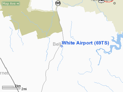
Location & QuickFacts
| FAA Information Effective: | 2008-09-25 |
| Airport Identifier: | 69TS |
| Airport Status: | Operational |
| Longitude/Latitude: | 097-45-21.0620W/30-59-55.6420N
-97.755851/30.998789 (Estimated) |
| Elevation: | 890 ft / 271.27 m (Estimated) |
| Land: | 0 acres |
| From nearest city: | 8 nautical miles S of Killeen, TX |
| Location: | Bell County, TX |
| Magnetic Variation: | 07E (1985) |
Owner & Manager
| Ownership: | Privately owned |
| Owner: | Preston Tucker |
| Address: | Rt 2 Box 166c
Killeen, TX 76542 |
| Phone number: | 817-526-7211 |
| Address: |
|
Airport Operations and Facilities
| Airport Use: | Private |
| Wind indicator: | Yes |
| Segmented Circle: | Yes |
| Control Tower: | No |
| Landing fee charge: | No |
| Sectional chart: | San Antonio |
| Region: | ASW - Southwest |
| Boundary ARTCC: | ZHU - Houston |
| Tie-in FSS: | SJT - San Angelo |
| FSS on Airport: | No |
| FSS Toll Free: | 1-800-WX-BRIEF |
Airport Services
| Airframe Repair: | NONE |
| Power Plant Repair: | NONE |
Runway Information
Runway 12/30
| Dimension: | 1500 x 100 ft / 457.2 x 30.5 m |
| Surface: | TURF, |
| |
Runway 12 |
Runway 30 |
| Traffic Pattern: | Left | Left |
|
Radio Navigation Aids
| ID |
Type |
Name |
Ch |
Freq |
Var |
Dist |
| IL | NDB | Iresh | | 278.00 | 07E | 2.9 nm |
| HLR | NDB | Hood | | 347.00 | 07E | 8.2 nm |
| GR | NDB | Starn | | 323.00 | 07E | 12.0 nm |
| GUO | NDB | Georgetown | | 332.00 | 06E | 19.3 nm |
| BMQ | NDB | Burnet | | 341.00 | 07E | 29.3 nm |
| MFS | NDB | Horseshoe Bay Resort | | 403.00 | 07E | 42.2 nm |
| MNZ | NDB | Hamilton | | 251.00 | 07E | 42.4 nm |
| ROB | NDB | Robinson | | 400.00 | 07E | 46.5 nm |
| GRK | VOR/DME | Gray | 055X | 111.80 | 07E | 3.6 nm |
| TPL | VOR/DME | Temple | 041X | 110.40 | 09E | 21.2 nm |
| LZZ | VORTAC | Lampasas | 072X | 112.50 | 08E | 22.8 nm |
| CWK | VORTAC | Centex | 075X | 112.80 | 06E | 39.1 nm |
| ACT | VORTAC | Waco | 100X | 115.30 | 09E | 47.1 nm |
Remarks
- PARA DROPS ON FIELD WEEKENDS AND HOLIDAYS.
Images and information placed above are from
http://www.airport-data.com/airport/69TS/
We thank them for the data!
| General Info
|
| Country |
United States
|
| State |
TEXAS
|
| FAA ID |
69TS
|
| Latitude |
30-59-55.642N
|
| Longitude |
097-45-21.062W
|
| Elevation |
890 feet
|
| Near City |
KILLEEN
|
We don't guarantee the information is fresh and accurate. The data may
be wrong or outdated.
For more up-to-date information please refer to other sources.
|
|


