 |
|
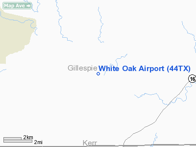
Location & QuickFacts
| FAA Information Effective: | 2008-09-25 |
| Airport Identifier: | 44TX |
| Airport Status: | Operational |
| Longitude/Latitude: | 099-05-41.1560W/30-12-37.7320N
-99.094766/30.210481 (Estimated) |
| Elevation: | 1875 ft / 571.50 m (Estimated) |
| Land: | 45 acres |
| From nearest city: | 14 nautical miles SW of Fredericksburg, TX |
| Location: | Gillespie County, TX |
| Magnetic Variation: | 08E (1985) |
Owner & Manager
| Ownership: | Privately owned |
| Owner: | Stan & Nabette Shannon |
| Address: | Rondure Company, 3033 White Oak Rd.
Fredericksburg, TX 78624 |
| Phone number: | 830-997-8802 |
| Manager: | Stan Shannon |
| Address: | Rondure Company, 3033 White Oak Rd.
Fredericksburg, TX 78624 |
| Phone number: | 830-997-8802 |
Airport Operations and Facilities
| Airport Use: | Private |
| Wind indicator: | Yes |
| Segmented Circle: | No |
| Control Tower: | No |
| Sectional chart: | San Antonio |
| Region: | ASW - Southwest |
| Boundary ARTCC: | ZHU - Houston |
| Tie-in FSS: | SJT - San Angelo |
| FSS on Airport: | No |
| FSS Toll Free: | 1-800-WX-BRIEF |
Airport Communications
Airport Services
Runway Information
Runway 17/35
| Dimension: | 2500 x 14 ft / 762.0 x 4.3 m |
| Surface: | ASPH, Good Condition |
| |
Runway 17 |
Runway 35 |
| Traffic Pattern: | Right | Left |
| Obstruction: | 30 ft trees, 250.0 ft from runway | 8 ft fence, 250.0 ft from runway |
|
Radio Navigation Aids
| ID |
Type |
Name |
Ch |
Freq |
Var |
Dist |
| ER | NDB | Shein | | 263.00 | 08E | 18.3 nm |
| MFS | NDB | Horseshoe Bay Resort | | 403.00 | 07E | 42.6 nm |
| CSI | VORTAC | Center Point | 122X | 117.50 | 08E | 18.4 nm |
| STV | VORTAC | Stonewall | 085X | 113.80 | 08E | 20.2 nm |
| LLO | VORTAC | Llano | 019X | 108.20 | 08E | 38.6 nm |
| JCT | VORTAC | Junction | 107X | 116.00 | 08E | 44.1 nm |
| SAT | VORTAC | San Antonio | 115X | 116.80 | 08E | 47.4 nm |
Images and information placed above are from
http://www.airport-data.com/airport/44TX/
We thank them for the data!
| General Info
|
| Country |
United States
|
| State |
TEXAS
|
| FAA ID |
44TX
|
| Latitude |
30-12-37.732N
|
| Longitude |
099-05-41.156W
|
| Elevation |
1875 feet
|
| Near City |
FREDERICKSBURG
|
We don't guarantee the information is fresh and accurate. The data may
be wrong or outdated.
For more up-to-date information please refer to other sources.
|
|


