 |
|
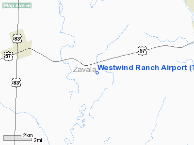
Location & QuickFacts
| FAA Information Effective: | 2008-09-25 |
| Airport Identifier: | TE83 |
| Airport Status: | Operational |
| Longitude/Latitude: | 099-45-22.1400W/28-55-14.8800N
-99.756150/28.920800 (Estimated) |
| Elevation: | 686 ft / 209.09 m (Estimated) |
| Land: | 16000 acres |
| From nearest city: | 7 nautical miles E of La Pryor, TX |
| Location: | Zavala County, TX |
| Magnetic Variation: | 07E (1995) |
Owner & Manager
| Ownership: | Privately owned |
| Owner: | Larry Martin |
| Address: | Po Box 55
La Pryor, TX 78872 |
| Phone number: | 830-376-4697 |
| Manager: | Les Kemmerer |
| Address: | Po Box 55
La Pryor, TX 78872 |
| Phone number: | 830-376-4697 |
Airport Operations and Facilities
| Airport Use: | Private |
| Segmented Circle: | No |
| Control Tower: | No |
| Lighting Schedule: | RDO-CTL
ACTVT ROTG BCN - 122.9. |
| Beacon Color: | Clear-Green (lighted land airport) |
| Sectional chart: | San Antonio |
| Region: | ASW - Southwest |
| Boundary ARTCC: | ZHU - Houston |
| Tie-in FSS: | SJT - San Angelo |
| FSS Toll Free: | 1-800-WX-BRIEF |
Runway Information
Runway 16/34
| Dimension: | 5117 x 50 ft / 1559.7 x 15.2 m |
| Surface: | ASPH, |
| Edge Lights: | Low |
| |
Runway 16 |
Runway 34 |
| Traffic Pattern: | Left | Left |
|
Radio Navigation Aids
| ID |
Type |
Name |
Ch |
Freq |
Var |
Dist |
| LKX | NDB | La Pryor | | 223.00 | 09E | 5.2 nm |
| CPZ | NDB | Chaparrosa Ranch | | 385.00 | 10E | 13.1 nm |
| UVA | NDB | Uvalde | | 281.00 | 07E | 15.5 nm |
| DMD | NDB | Dimmit County | | 343.00 | 07E | 24.2 nm |
| PFO | NDB | Spofford | | 356.00 | 08E | 37.8 nm |
| HMA | NDB | Hondo | | 329.00 | 08E | 41.0 nm |
| HHH | NDB | Devine | | 359.00 | 07E | 44.9 nm |
| BRX | NDB | La Fonda Ranch | | 269.00 | 09E | 48.8 nm |
| HDO | VOR/DME | Hondo | 31X | 109.40 | 08E | 39.8 nm |
| COT | VORTAC | Cotulla | 105X | 115.80 | 09E | 43.5 nm |
Images and information placed above are from
http://www.airport-data.com/airport/TE83/
We thank them for the data!
| General Info
|
| Country |
United States
|
| State |
TEXAS
|
| FAA ID |
TE83
|
| Latitude |
28-55-14.880N
|
| Longitude |
099-45-22.140W
|
| Elevation |
686 feet
|
| Near City |
LA PRYOR
|
We don't guarantee the information is fresh and accurate. The data may
be wrong or outdated.
For more up-to-date information please refer to other sources.
|
|


