 |
|
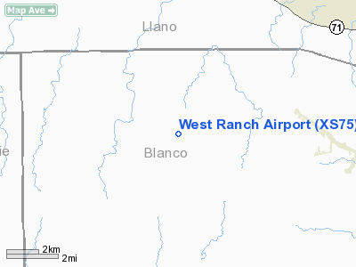
Location & QuickFacts
| FAA Information Effective: | 2008-09-25 |
| Airport Identifier: | XS75 |
| Airport Status: | Closed Indefinitely |
| Longitude/Latitude: | 098-29-21.1010W/30-27-15.6950N
-98.489195/30.454360 (Estimated) |
| Elevation: | 1470 ft / 448.06 m (Estimated) |
| Land: | 0 acres |
| From nearest city: | 8 nautical miles W of Round Mountain, TX |
| Location: | Blanco County, TX |
| Magnetic Variation: | 07E (1985) |
Owner & Manager
| Ownership: | Privately owned |
| Owner: | W W West |
| Address: | West Ranch
Round Mountain, TX 78663 |
| Phone number: | 512-825-3461 |
| Manager: | Kermit Sultemeier |
| Address: | Star Route 3 Box 455
Round Mountain, TX 78663 |
| Phone number: | 512-825-3461 |
Airport Operations and Facilities
| Airport Use: | Private |
| Wind indicator: | Yes |
| Segmented Circle: | No |
| Control Tower: | No |
| Lighting Schedule: | PHONE REQ
FOR RWY LGTS, PHONE 512-825-3461 |
| Landing fee charge: | No |
| Sectional chart: | San Antonio |
| Region: | ASW - Southwest |
| Boundary ARTCC: | ZHU - Houston |
| Tie-in FSS: | SJT - San Angelo |
| FSS on Airport: | No |
| FSS Toll Free: | 1-800-WX-BRIEF |
Airport Services
| Airframe Repair: | NONE |
| Power Plant Repair: | NONE |
Runway Information
Runway 17/35
| Dimension: | 3950 x 100 ft / 1204.0 x 30.5 m |
| Surface: | ASPH, Poor Condition
UNSAFE; RY CRUMBLING. |
| Edge Lights: | Low |
| |
Runway 17 |
Runway 35 |
| Traffic Pattern: | Left | Left |
|
Radio Navigation Aids
| ID |
Type |
Name |
Ch |
Freq |
Var |
Dist |
| MFS | NDB | Horseshoe Bay Resort | | 403.00 | 07E | 8.0 nm |
| BMQ | NDB | Burnet | | 341.00 | 07E | 21.6 nm |
| ER | NDB | Shein | | 263.00 | 08E | 42.2 nm |
| GUO | NDB | Georgetown | | 332.00 | 06E | 44.1 nm |
| GRK | VOR/DME | Gray | 055X | 111.80 | 07E | 49.3 nm |
| STV | VORTAC | Stonewall | 085X | 113.80 | 08E | 18.6 nm |
| LLO | VORTAC | Llano | 019X | 108.20 | 08E | 25.7 nm |
| LZZ | VORTAC | Lampasas | 072X | 112.50 | 08E | 47.5 nm |
| SAT | VORTAC | San Antonio | 115X | 116.80 | 08E | 48.7 nm |
| CSI | VORTAC | Center Point | 122X | 117.50 | 08E | 49.4 nm |
| CWK | VORTAC | Centex | 075X | 112.80 | 06E | 49.9 nm |
Remarks
- 459' TWR 4200' EAST;25' BARN 200' WEST.
- LIVESTOCK MAY BE ON RWY.
- RUNWAY IS BUILT ON HILLSIDE-ACTUAL ELEVATIONS VARY MARKEDLY.
- (ARPT STATUS) ARPT CLSD INDEFLY.
Images and information placed above are from
http://www.airport-data.com/airport/XS75/
We thank them for the data!
| General Info
|
| Country |
United States
|
| State |
TEXAS
|
| FAA ID |
XS75
|
| Latitude |
30-27-15.695N
|
| Longitude |
098-29-21.101W
|
| Elevation |
1470 feet
|
| Near City |
ROUND MOUNTAIN
|
We don't guarantee the information is fresh and accurate. The data may
be wrong or outdated.
For more up-to-date information please refer to other sources.
|
|


