 |
|
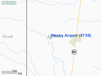
Location & QuickFacts
| FAA Information Effective: | 2008-09-25 |
| Airport Identifier: | 8TX8 |
| Airport Status: | Operational |
| Longitude/Latitude: | 098-10-46.0180W/27-21-39.1390N
-98.179449/27.360872 (Estimated) |
| Elevation: | 190 ft / 57.91 m (Estimated) |
| Land: | 120 acres |
| From nearest city: | 3 nautical miles E of Premont, TX |
| Location: | Jim Wells County, TX |
| Magnetic Variation: | 07E (1985) |
Owner & Manager
| Ownership: | Privately owned |
| Owner: | Mike Weeks |
| Address: | Po Drawer 1169
Premont, TX 78375 |
| Phone number: | 512-339-8550 |
| Address: |
|
Airport Operations and Facilities
| Airport Use: | Private |
| Segmented Circle: | No |
| Control Tower: | No |
| Sectional chart: | Brownsville |
| Region: | ASW - Southwest |
| Boundary ARTCC: | ZHU - Houston |
| Tie-in FSS: | SJT - San Angelo |
| FSS on Airport: | No |
| FSS Toll Free: | 1-800-WX-BRIEF |
Runway Information
Runway 15/33
| Dimension: | 3800 x 60 ft / 1158.2 x 18.3 m |
| Surface: | TURF, |
| |
Runway 15 |
Runway 33 |
| Traffic Pattern: | Left | Left |
|
Radio Navigation Aids
| ID |
Type |
Name |
Ch |
Freq |
Var |
Dist |
| BKS | NDB | Brooks County | | 353.00 | 06E | 9.8 nm |
| TKB | NDB | Kleberg County | | 347.00 | 06E | 15.6 nm |
| HBV | NDB | Hebbronville | | 266.00 | 06E | 30.1 nm |
| SNE | NDB | Santa Elena | | 260.00 | 07E | 44.1 nm |
| NQI | TACAN | Kingsville | 125X | | 09E | 21.6 nm |
| NOG | TACAN | Orange Grove | 063X | | 09E | 32.9 nm |
| ALI | VOR | Alice | | 114.50 | 06E | 24.3 nm |
Images and information placed above are from
http://www.airport-data.com/airport/8TX8/
We thank them for the data!
| General Info
|
| Country |
United States
|
| State |
TEXAS
|
| FAA ID |
8TX8
|
| Latitude |
27-21-39.139N
|
| Longitude |
098-10-46.018W
|
| Elevation |
190 feet
|
| Near City |
PREMONT
|
We don't guarantee the information is fresh and accurate. The data may
be wrong or outdated.
For more up-to-date information please refer to other sources.
|
|


