 |
|
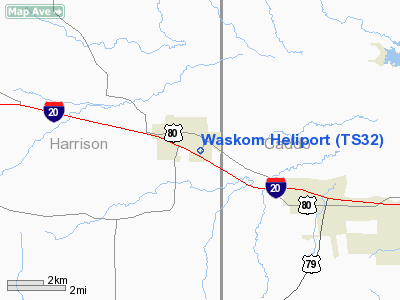
Location & QuickFacts
| FAA Information Effective: | 2008-09-25 |
| Airport Identifier: | TS32 |
| Airport Status: | Operational |
| Longitude/Latitude: | 094-03-19.6690W/32-28-14.5530N
-94.055464/32.470709 (Estimated) |
| Elevation: | 280 ft / 85.34 m (Estimated) |
| Land: | 0 acres |
| From nearest city: | 0 nautical miles N of Waskom, TX |
| Location: | Harrison County, TX |
| Magnetic Variation: | 05E (1990) |
Owner & Manager
| Ownership: | Privately owned |
| Owner: | Waskom Emergency Medical Svcs |
| Address: | Po Box 237
Waskom, TX 75692 |
| Phone number: | 903-687-3374 |
| Manager: | Richard Jones, Assist Chief |
| Address: | Po Box 1385
Waskom, TX 75692 |
| Phone number: | 903-687-3374 |
Airport Operations and Facilities
| Airport Use: | Private
MEDICAL USE. |
| Segmented Circle: | No |
| Control Tower: | No |
| Lighting Schedule: | PHONE REQ
FOR PERIMETER LGTS CALL 903-687-3374. |
| Sectional chart: | Memphis |
| Region: | ASW - Southwest |
| Boundary ARTCC: | ZFW - Fort Worth |
| Tie-in FSS: | FTW - Fort Worth |
| FSS on Airport: | No |
| FSS Phone: | 817-541-3474 |
| FSS Toll Free: | 1-800-WX-BRIEF |
Runway Information
Helipad H1
| Dimension: | 50 x 50 ft / 15.2 x 15.2 m |
| Surface: | CONC, |
| |
Runway H1 |
Runway |
| Traffic Pattern: | Left | Left |
|
Radio Navigation Aids
| ID |
Type |
Name |
Ch |
Freq |
Var |
Dist |
| RPF | NDB | Carthage | | 332.00 | 04E | 21.3 nm |
| VIV | NDB | Vivian | | 284.00 | 06E | 23.5 nm |
| MSD | NDB | Mansfield | | 414.00 | 04E | 28.6 nm |
| ATA | NDB | Atlanta | | 347.00 | 04E | 38.7 nm |
| CZJ | NDB | Amason | | 341.00 | 04E | 38.7 nm |
| MNE | NDB | Minden | | 201.00 | 04E | 39.5 nm |
| SPH | NDB | Springhill | | 375.00 | 05E | 42.4 nm |
| HNO | NDB | Henderson | | 371.00 | 06E | 44.3 nm |
| LST | NDB | Lone Star | | 305.00 | 05E | 44.3 nm |
| BAD | TACAN | Barksdale | 105X | | 05E | 19.8 nm |
| DTN | VOR | Downtown | | 108.60 | 07E | 16.5 nm |
| EIC | VORTAC | Belcher | 121X | 117.40 | 07E | 21.9 nm |
| EMG | VORTAC | Elm Grove | 049X | 111.20 | 07E | 23.7 nm |
| GGG | VORTAC | Gregg County | 070X | 112.30 | 07E | 35.5 nm |
| SHV | VOT | Shreveport Regional | | 108.20 | | 14.1 nm |
Images and information placed above are from
http://www.airport-data.com/airport/TS32/
We thank them for the data!
| General Info
|
| Country |
United States
|
| State |
TEXAS
|
| FAA ID |
TS32
|
| Latitude |
32-28-14.553N
|
| Longitude |
094-03-19.669W
|
| Elevation |
280 feet
|
| Near City |
WASKOM
|
We don't guarantee the information is fresh and accurate. The data may
be wrong or outdated.
For more up-to-date information please refer to other sources.
|
|


