 |
|
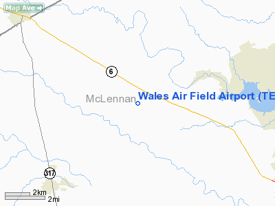
Location & QuickFacts
| FAA Information Effective: | 2008-09-25 |
| Airport Identifier: | TE92 |
| Airport Status: | Operational |
| Longitude/Latitude: | 097-22-15.1500W/31-35-39.8300N
-97.370875/31.594397 (Estimated) |
| Elevation: | 640 ft / 195.07 m (Estimated) |
| Land: | 20 acres |
| From nearest city: | 10 nautical miles N of Waco, TX |
| Location: | Mc Lennan County, TX |
| Magnetic Variation: | 06E (2000) |
Owner & Manager
| Ownership: | Privately owned |
| Owner: | R. W. Wales |
| Address: | 1242 Compton Road
Crawford, TX 76638 |
| Phone number: | 254-848-5583 |
| Manager: | R. W. Wales |
| Address: | 1242 Compton Road
Crawford, TX 76638 |
| Phone number: | 254-848-5583 |
Airport Operations and Facilities
| Airport Use: | Private |
| Wind indicator: | Yes |
| Segmented Circle: | No |
| Control Tower: | No |
| Lighting Schedule: | DUSK-DAWN |
| Beacon Color: | Clear (unlighted land airport) |
| Sectional chart: | San Antonio |
| Region: | ASW - Southwest |
| Boundary ARTCC: | ZFW - Fort Worth |
| Tie-in FSS: | FTW - Fort Worth |
| FSS Phone: | 817-541-3474 |
| FSS Toll Free: | 1-800-WX-BRIEF |
Runway Information
Runway 17/35
| Dimension: | 1200 x 80 ft / 365.8 x 24.4 m |
| Surface: | TURF, |
| |
Runway 17 |
Runway 35 |
| Traffic Pattern: | Left | Left |
| Obstruction: | 5 ft fence | 25 ft pline, 0.0 ft from runway |
|
Radio Navigation Aids
| ID |
Type |
Name |
Ch |
Freq |
Var |
Dist |
| ROB | NDB | Robinson | | 400.00 | 07E | 16.4 nm |
| HLR | NDB | Hood | | 347.00 | 07E | 33.0 nm |
| GR | NDB | Starn | | 323.00 | 07E | 36.5 nm |
| IL | NDB | Iresh | | 278.00 | 07E | 38.4 nm |
| MNZ | NDB | Hamilton | | 251.00 | 07E | 39.8 nm |
| LXY | NDB | Mexia | | 329.00 | 07E | 44.0 nm |
| TPL | VOR/DME | Temple | 041X | 110.40 | 09E | 23.3 nm |
| GRK | VOR/DME | Gray | 055X | 111.80 | 07E | 40.7 nm |
| GNL | VOR/DME | Groesbeck | 025X | 108.80 | 05E | 42.1 nm |
| ACT | VORTAC | Waco | 100X | 115.30 | 09E | 6.6 nm |
| JEN | VORTAC | Glen Rose | 097X | 115.00 | 06E | 42.7 nm |
| LZZ | VORTAC | Lampasas | 072X | 112.50 | 08E | 46.6 nm |
Images and information placed above are from
http://www.airport-data.com/airport/TE92/
We thank them for the data!
| General Info
|
| Country |
United States
|
| State |
TEXAS
|
| FAA ID |
TE92
|
| Latitude |
31-35-39.830N
|
| Longitude |
097-22-15.150W
|
| Elevation |
640 feet
|
| Near City |
WACO
|
We don't guarantee the information is fresh and accurate. The data may
be wrong or outdated.
For more up-to-date information please refer to other sources.
|
|


