 |
|
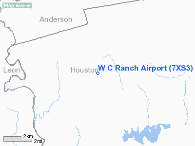
Location & QuickFacts
| FAA Information Effective: | 2008-09-25 |
| Airport Identifier: | 7XS3 |
| Airport Status: | Operational |
| Longitude/Latitude: | 095-38-05.8310W/31-28-35.6390N
-95.634953/31.476566 (Estimated) |
| Elevation: | 337 ft / 102.72 m (Estimated) |
| Land: | 0 acres |
| From nearest city: | 9 nautical miles W of Grapeland, TX |
| Location: | Houston County, TX |
| Magnetic Variation: | 06E (1985) |
Owner & Manager
| Ownership: | Privately owned |
| Owner: | Grant Whitaker |
| Address: | P.o. Box 670107
Houston, TX 77067 |
| Phone number: | 713-872-8600 |
| Manager: | Grant E. Whitaker |
| Address: | P.o. Box 690
Grapeland, TX 75844 |
| Phone number: | 409-687-2697 |
Airport Operations and Facilities
| Airport Use: | Private |
| Wind indicator: | Yes |
| Segmented Circle: | No |
| Control Tower: | No |
| Landing fee charge: | No |
| Sectional chart: | Houston |
| Region: | ASW - Southwest |
| Boundary ARTCC: | ZHU - Houston |
| Tie-in FSS: | CXO - Montgomery County |
| FSS on Airport: | No |
| FSS Toll Free: | 1-800-WX-BRIEF |
Runway Information
Runway 16/34
| Dimension: | 2600 x 50 ft / 792.5 x 15.2 m |
| Surface: | TURF, |
| |
Runway 16 |
Runway 34 |
| Traffic Pattern: | Left | Left |
|
Radio Navigation Aids
| ID |
Type |
Name |
Ch |
Freq |
Var |
Dist |
| PSN | NDB | Palestine | | 375.00 | 04E | 18.6 nm |
| JSO | NDB | Cherokee County | | 263.00 | 05E | 31.9 nm |
| LIQ | NDB | Lochridge Ranch | | 335.00 | 09E | 36.0 nm |
| PYF | NDB | Pyramid | | 418.00 | 06E | 37.0 nm |
| CSZ | NDB | Crossroads | | 215.00 | 08E | 38.9 nm |
| AHX | NDB | Athens | | 269.00 | 06E | 42.2 nm |
| UTS | NDB | Huntsville | | 308.00 | 06E | 44.3 nm |
| LXY | NDB | Mexia | | 329.00 | 07E | 46.0 nm |
| OC | NDB | Nados | | 253.00 | 05E | 46.9 nm |
| GXD | NDB | Nacogdoches | | 391.00 | 05E | 48.7 nm |
| FZT | VOR/DME | Frankston | 051X | 111.40 | 06E | 36.3 nm |
| GNL | VOR/DME | Groesbeck | 025X | 108.80 | 05E | 47.3 nm |
| LOA | VORTAC | Leona | 045X | 110.80 | 08E | 27.2 nm |
Images and information placed above are from
http://www.airport-data.com/airport/7XS3/
We thank them for the data!
| General Info
|
| Country |
United States
|
| State |
TEXAS
|
| FAA ID |
7XS3
|
| Latitude |
31-28-35.639N
|
| Longitude |
095-38-05.831W
|
| Elevation |
337 feet
|
| Near City |
GRAPELAND
|
We don't guarantee the information is fresh and accurate. The data may
be wrong or outdated.
For more up-to-date information please refer to other sources.
|
|


