 |
|
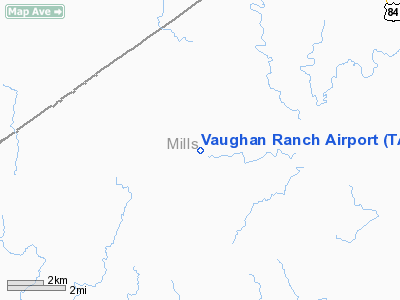
Location & QuickFacts
| FAA Information Effective: | 2008-09-25 |
| Airport Identifier: | TA89 |
| Airport Status: | Operational |
| Longitude/Latitude: | 098-48-01.1720W/31-31-25.5860N
-98.800326/31.523774 (Estimated) |
| Elevation: | 1310 ft / 399.29 m (Estimated) |
| Land: | 0 acres |
| From nearest city: | 10 nautical miles SW of Mullin, TX |
| Location: | Mills County, TX |
| Magnetic Variation: | 08E (1985) |
Owner & Manager
| Ownership: | Privately owned |
| Owner: | Westchester Gas Company |
| Address: | Po Box 1
Jonesville, TX 75659 |
| Phone number: | 903-687-3264 |
| Address: |
|
Airport Operations and Facilities
| Airport Use: | Private |
| Wind indicator: | Yes |
| Segmented Circle: | No |
| Control Tower: | No |
| Sectional chart: | San Antonio |
| Region: | ASW - Southwest |
| Boundary ARTCC: | ZFW - Fort Worth |
| Tie-in FSS: | SJT - San Angelo |
| FSS on Airport: | No |
| FSS Toll Free: | 1-800-WX-BRIEF |
Airport Services
Runway Information
Runway 01/19
| Dimension: | 5000 x 60 ft / 1524.0 x 18.3 m |
| Surface: | ASPH, |
| |
Runway 01 |
Runway 19 |
| Traffic Pattern: | Left | Left |
|
Radio Navigation Aids
| ID |
Type |
Name |
Ch |
Freq |
Var |
Dist |
| BBD | NDB | Brady | | 380.00 | 07E | 33.9 nm |
| MNZ | NDB | Hamilton | | 251.00 | 07E | 33.9 nm |
| COM | NDB | Coleman | | 385.00 | 07E | 36.4 nm |
| BWD | VOR/DME | Brownwood | 023X | 108.60 | 08E | 23.6 nm |
| LZZ | VORTAC | Lampasas | 072X | 112.50 | 08E | 39.4 nm |
| LLO | VORTAC | Llano | 019X | 108.20 | 08E | 43.7 nm |
Images and information placed above are from
http://www.airport-data.com/airport/TA89/
We thank them for the data!
| General Info
|
| Country |
United States
|
| State |
TEXAS
|
| FAA ID |
TA89
|
| Latitude |
31-31-25.586N
|
| Longitude |
098-48-01.172W
|
| Elevation |
1310 feet
|
| Near City |
MULLIN
|
We don't guarantee the information is fresh and accurate. The data may
be wrong or outdated.
For more up-to-date information please refer to other sources.
|
|


