 |
|
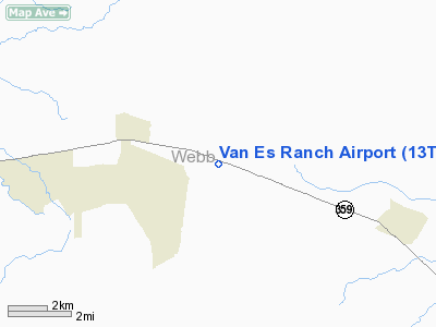
Location & QuickFacts
| FAA Information Effective: | 2008-09-25 |
| Airport Identifier: | 13TS |
| Airport Status: | Operational |
| Longitude/Latitude: | 098-55-35.0850W/27-27-19.1050N
-98.926413/27.455307 (Estimated) |
| Elevation: | 830 ft / 252.98 m (Estimated) |
| Land: | 430 acres |
| From nearest city: | 2 nautical miles W of Oilton, TX |
| Location: | Webb County, TX |
| Magnetic Variation: | 07E (1986) |
Owner & Manager
| Ownership: | Privately owned |
| Owner: | Edward Vanes |
| Address: | 1607 Corpus Christi
Laredo, TX 78040 |
| Phone number: | 512-586-4753 |
| Address: |
|
Airport Operations and Facilities
| Airport Use: | Private |
| Wind indicator: | Yes |
| Segmented Circle: | No |
| Control Tower: | No |
| Sectional chart: | Brownsville |
| Region: | ASW - Southwest |
| Boundary ARTCC: | ZHU - Houston |
| Tie-in FSS: | SJT - San Angelo |
| FSS Toll Free: | 1-800-WX-BRIEF |
Runway Information
Runway 11/29
| Dimension: | 3000 x 30 ft / 914.4 x 9.1 m |
| Surface: | DIRT, |
| |
Runway 11 |
Runway 29 |
| Traffic Pattern: | Left | Left |
|
Radio Navigation Aids
| ID |
Type |
Name |
Ch |
Freq |
Var |
Dist |
| HBV | NDB | Hebbronville | | 266.00 | 06E | 11.5 nm |
| BKS | NDB | Brooks County | | 353.00 | 06E | 45.5 nm |
| TKB | NDB | Kleberg County | | 347.00 | 06E | 45.7 nm |
| SNE | NDB | Santa Elena | | 260.00 | 07E | 48.0 nm |
| NLD | VOR/DME | Nuevo Laredo | 073X | 112.60 | 09E | 34.2 nm |
| LRD | VORTAC | Laredo | 121X | 117.40 | 09E | 26.2 nm |
Images and information placed above are from
http://www.airport-data.com/airport/13TS/
We thank them for the data!
| General Info
|
| Country |
United States
|
| State |
TEXAS
|
| FAA ID |
13TS
|
| Latitude |
27-27-19.105N
|
| Longitude |
098-55-35.085W
|
| Elevation |
830 feet
|
| Near City |
OILTON
|
We don't guarantee the information is fresh and accurate. The data may
be wrong or outdated.
For more up-to-date information please refer to other sources.
|
|


