 |
|
Location & QuickFacts
| FAA Information Effective: | 2008-09-25 |
| Airport Identifier: | 41TE |
| Airport Status: | Operational |
| Longitude/Latitude: | 099-06-44.1430W/30-00-51.7660N
-99.112262/30.014379 (Estimated) |
| Elevation: | 1600 ft / 487.68 m (Estimated) |
| Land: | 1 acres |
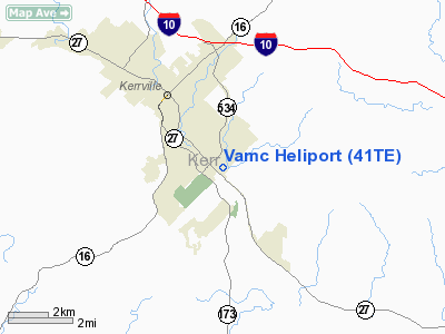
| From nearest city: | 3 nautical miles SE of Kerrville, TX |
| Location: | Kerr County, TX |
| Magnetic Variation: | 07E (1985) |
Owner & Manager
| Ownership: | Publicly owned |
| Owner: | V.a. Medical Center |
| Address: | 3600 Memorial Blvd
Kerrville, TX 78028 |
| Phone number: | 830-896-2020 |
| Manager: | Walter B Conner |
| Address: | V.a. Medical Center
Kerrville, TX 78028 |
| Phone number: | 830-792-2558 |
Airport Operations and Facilities
| Airport Use: | Private
MEDICAL. |
| Wind indicator: | Yes |
| Segmented Circle: | No |
| Control Tower: | No |
| Lighting Schedule: | DUSK-DAWN |
| Beacon Color: | Clear-Green-Yellow (heliport) |
| Landing fee charge: | No |
| Sectional chart: | San Antonio |
| Region: | ASW - Southwest |
| Boundary ARTCC: | ZHU - Houston |
| Tie-in FSS: | SJT - San Angelo |
| FSS on Airport: | No |
| FSS Toll Free: | 1-800-WX-BRIEF |
Airport Services
| Airframe Repair: | NONE |
| Power Plant Repair: | NONE |
Runway Information
Helipad H1
| Dimension: | 90 x 90 ft / 27.4 x 27.4 m |
| Surface: | CONC, Good Condition |
| Weight Limit: | Single wheel: 20000 lbs. |
| |
Runway H1 |
Runway |
| Traffic Pattern: | Left | Left |
|
Radio Navigation Aids
| ID |
Type |
Name |
Ch |
Freq |
Var |
Dist |
| ER | NDB | Shein | | 263.00 | 08E | 8.0 nm |
| HMA | NDB | Hondo | | 329.00 | 08E | 38.7 nm |
| CVB | NDB | Castroville | | 338.00 | 08E | 42.5 nm |
| MFS | NDB | Horseshoe Bay Resort | | 403.00 | 07E | 49.7 nm |
| KSY | TACAN | Kelly | 057X | | 07E | 46.6 nm |
| HDO | VOR/DME | Hondo | 31X | 109.40 | 08E | 40.1 nm |
| CSI | VORTAC | Center Point | 122X | 117.50 | 08E | 7.7 nm |
| STV | VORTAC | Stonewall | 085X | 113.80 | 08E | 24.1 nm |
| SAT | VORTAC | San Antonio | 115X | 116.80 | 08E | 40.6 nm |
| LLO | VORTAC | Llano | 019X | 108.20 | 08E | 49.9 nm |
| SAT | VOT | San Antonio Intl | | 110.40 | | 44.2 nm |
Remarks
- (A42-H1-1) BASIC HOSPITAL MARKING - GOOD.
- VFR ONLY
Images and information placed above are from
http://www.airport-data.com/airport/41TE/
We thank them for the data!
| General Info
|
| Country |
United States
|
| State |
TEXAS
|
| FAA ID |
41TE
|
| Latitude |
30-00-51.766N
|
| Longitude |
099-06-44.143W
|
| Elevation |
1600 feet
|
| Near City |
KERRVILLE
|
We don't guarantee the information is fresh and accurate. The data may
be wrong or outdated.
For more up-to-date information please refer to other sources.
|
|


