 |
|
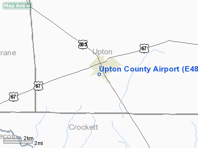
Location & QuickFacts
| FAA Information Effective: | 2008-09-25 |
| Airport Identifier: | E48 |
| Airport Status: | Operational |
| Longitude/Latitude: | 102-13-31.4940W/31-07-30.5340N
-102.225415/31.125148 (Estimated) |
| Elevation: | 2433 ft / 741.58 m (Surveyed) |
| Land: | 380 acres |
| From nearest city: | 1 nautical miles SW of Mc Camey, TX |
| Location: | Upton County, TX |
| Magnetic Variation: | 09E (1985) |
Owner & Manager
| Ownership: | Publicly owned |
| Owner: | Upton County |
| Address: | Co Court House/po Box 482
Rankin, TX 79778 |
| Phone number: | 432-693-2321 |
| Manager: | Willie Martinez
COUNTY COMMISSIONER. |
| Address: | Po Box 1215
Mc Camey, TX 79752 |
| Phone number: | 432-652-8825
ALTERNATE NUMBER: 432-416-6754. |
Airport Operations and Facilities
| Airport Use: | Open to public |
| Wind indicator: | Yes |
| Segmented Circle: | Yes |
| Control Tower: | No |
| Lighting Schedule: | DUSK-DAWN |
| Beacon Color: | Clear-Green (lighted land airport)
ROTG BCN OTS INDEFLY. |
| Landing fee charge: | No |
| Sectional chart: | San Antonio |
| Region: | ASW - Southwest |
| Boundary ARTCC: | ZAB - Albuquerque |
| Tie-in FSS: | SJT - San Angelo |
| FSS on Airport: | No |
| FSS Toll Free: | 1-800-WX-BRIEF |
| NOTAMs Facility: | SJT (NOTAM-d service avaliable) |
| Federal Agreements: | Y1 |
Airport Communications
Airport Services
| Bottled Oxygen: | NONE |
| Bulk Oxygen: | NONE |
Runway Information
Runway 06/24
| Dimension: | 4450 x 140 ft / 1356.4 x 42.7 m |
| Surface: | TURF, Fair Condition |
| |
Runway 06 |
Runway 24 |
| Traffic Pattern: | Right | Left |
| Obstruction: | 8 ft brush | 10 ft road, 10.0 ft from runway, 1:1 slope to clear |
|
Runway 10/28
| Dimension: | 4100 x 75 ft / 1249.7 x 22.9 m |
| Surface: | ASPH, Fair Condition |
| Weight Limit: | Single wheel: 30000 lbs. |
| Edge Lights: | Low
LIRL OTS INDEFLY. |
| |
Runway 10 |
Runway 28 |
| Traffic Pattern: | Right | Left |
| Markings: | Basic, Poor Condition
RY MARKINGS ARE FADED AND OBSCURED. | Basic, Poor Condition
RY MARKINGS ARE FADED AND OBSCURED. |
| Obstruction: | 10 ft brush, 385.0 ft from runway, 18:1 slope to clear | 18 ft trees, 530.0 ft from runway, 125 ft right of centerline, 18:1 slope to clear
ROADWAY 50-100 FT FM THLD; 10-12 FT BRUSH ALONG SOUTH SIDE OF RY 125 FT LEFT. |
|
Runway 15/33
| Dimension: | 3800 x 120 ft / 1158.2 x 36.6 m |
| Surface: | TURF, Good Condition |
| |
Runway 15 |
Runway 33 |
| Traffic Pattern: | Right | Left |
| Obstruction: | 25 ft pline, 60 ft left of centerline | 12 ft brush, 0.0 ft from runway |
|
Radio Navigation Aids
| ID |
Type |
Name |
Ch |
Freq |
Var |
Dist |
| OHE | NDB | Monahans | | 214.00 | 09E | 44.3 nm |
| FST | VORTAC | Fort Stockton | 116X | 116.90 | 11E | 40.0 nm |
| MAF | VOT | Midland International | | 108.20 | | 48.8 nm |
Remarks
Images and information placed above are from
http://www.airport-data.com/airport/E48/
We thank them for the data!
| General Info
|
| Country |
United States
|
| State |
TEXAS
|
| FAA ID |
E48
|
| Latitude |
31-07-30.534N
|
| Longitude |
102-13-31.494W
|
| Elevation |
2433 feet
|
| Near City |
MC CAMEY
|
We don't guarantee the information is fresh and accurate. The data may
be wrong or outdated.
For more up-to-date information please refer to other sources.
|
|


