 |
|
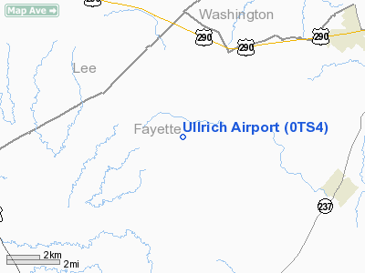
Location & QuickFacts
| FAA Information Effective: | 2008-09-25 |
| Airport Identifier: | 0TS4 |
| Airport Status: | Operational |
| Longitude/Latitude: | 096-47-41.9210W/30-05-30.7880N
-96.794978/30.091886 (Estimated) |
| Elevation: | 410 ft / 124.97 m (Estimated) |
| Land: | 0 acres |
| From nearest city: | 5 nautical miles S of Ledbetter, TX |
| Location: | Fayette County, TX |
| Magnetic Variation: | 06E (1990) |
Owner & Manager
| Ownership: | Privately owned |
| Owner: | George O. Ullrich |
| Address: | P.o. Box 167
Ledbetter, TX 78946 |
| Phone number: | 409-249-3730 |
| Address: |
|
Airport Operations and Facilities
| Airport Use: | Private |
| Segmented Circle: | No |
| Control Tower: | No |
| Sectional chart: | Houston |
| Region: | ASW - Southwest |
| Boundary ARTCC: | ZHU - Houston |
| Tie-in FSS: | CXO - Montgomery County |
| FSS on Airport: | No |
| FSS Toll Free: | 1-800-WX-BRIEF |
Runway Information
Runway 18/36
| Dimension: | 1800 x 60 ft / 548.6 x 18.3 m |
| Surface: | TURF, |
| |
Runway 18 |
Runway 36 |
| Traffic Pattern: | Left | Left |
|
Radio Navigation Aids
| ID |
Type |
Name |
Ch |
Freq |
Var |
Dist |
| GYB | NDB | Lee County | | 385.00 | 07E | 10.6 nm |
| BNH | NDB | Brenham | | 362.00 | 06E | 23.3 nm |
| ELA | VOR/DME | Eagle Lake | 111X | 116.40 | 08E | 35.9 nm |
| IDU | VORTAC | Industry | 039X | 110.20 | 08E | 14.6 nm |
| CLL | VORTAC | College Station | 080X | 113.30 | 08E | 36.4 nm |
| TNV | VORTAC | Navasota | 106X | 115.90 | 08E | 40.1 nm |
| CWK | VORTAC | Centex | 075X | 112.80 | 06E | 41.9 nm |
Images and information placed above are from
http://www.airport-data.com/airport/0TS4/
We thank them for the data!
| General Info
|
| Country |
United States
|
| State |
TEXAS
|
| FAA ID |
0TS4
|
| Latitude |
30-05-30.788N
|
| Longitude |
096-47-41.921W
|
| Elevation |
410 feet
|
| Near City |
LEDBETTER
|
We don't guarantee the information is fresh and accurate. The data may
be wrong or outdated.
For more up-to-date information please refer to other sources.
|
|


