 |
|
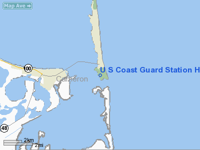
U S Coast Guard Station Heliport |
Location & QuickFacts
| FAA Information Effective: | 2008-09-25 |
| Airport Identifier: | TX57 |
| Airport Status: | Operational |
| Longitude/Latitude: | 097-09-48.8970W/26-04-20.2810N
-97.163583/26.072300 (Estimated) |
| Elevation: | 4 ft / 1.22 m (Estimated) |
| Land: | 0 acres |
| From nearest city: | 3 nautical miles W of Port Isabel, TX |
| Location: | Cameron County, TX |
| Magnetic Variation: | 07E (1985) |
Owner & Manager
| Ownership: | Publicly owned |
| Owner: | U S Coast Guard (aosr) |
| Address: | 501 Magazine St.
New Orleans, LA 70130 |
| Phone number: | 504-589-6230 |
| Manager: | Officer-in-charge |
| Address: | Wallace Reed Rd.
South Padre, TX 78597 |
| Phone number: | 210-761-2668 |
Airport Operations and Facilities
| Airport Use: | Private |
| Segmented Circle: | No |
| Control Tower: | No |
| Sectional chart: | Brownsville |
| Region: | ASW - Southwest |
| Boundary ARTCC: | ZHU - Houston |
| Tie-in FSS: | SJT - San Angelo |
| FSS Toll Free: | 1-800-WX-BRIEF |
Runway Information
Helipad H1
| Dimension: | 94 x 81 ft / 28.7 x 24.7 m
HELIPAD WITHIN A 154 X 128' LANDING/TKOF AREA. |
| Surface: | CONC, Good Condition |
| |
Runway H1 |
Runway |
| Traffic Pattern: | Left | Left |
| Markings: | Basic, | , |
|
Radio Navigation Aids
| ID |
Type |
Name |
Ch |
Freq |
Var |
Dist |
| MAM | VOR/DME | Matamoros | 090X | 114.30 | 07E | 26.6 nm |
| HRL | VOR/DME | Harlingen | 029X | 109.20 | 05E | 28.0 nm |
| BRO | VORTAC | Brownsville | 110X | 116.30 | 09E | 14.5 nm |
Images and information placed above are from
http://www.airport-data.com/airport/TX57/
We thank them for the data!
| General Info
|
| Country |
United States
|
| State |
TEXAS
|
| FAA ID |
TX57
|
| Latitude |
26-04-20.281N
|
| Longitude |
097-09-48.897W
|
| Elevation |
4 feet
|
| Near City |
PORT ISABEL
|
We don't guarantee the information is fresh and accurate. The data may
be wrong or outdated.
For more up-to-date information please refer to other sources.
|
|


