 |
|
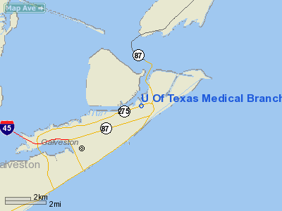
U Of Texas Medical Branch Emergency Room Heliport |
Location & QuickFacts
| FAA Information Effective: | 2008-09-25 |
| Airport Identifier: | 9TA7 |
| Airport Status: | Operational |
| Longitude/Latitude: | 094-46-44.5400W/29-18-44.7900N
-94.779039/29.312442 (Estimated) |
| Elevation: | 35 ft / 10.67 m (Estimated) |
| Land: | 0 acres |
| From nearest city: | 0 nautical miles N of Galveston, TX |
| Location: | Galveston County, TX |
| Magnetic Variation: | 05E (1990) |
Owner & Manager
| Ownership: | Privately owned |
| Owner: | U Of Texas Medical Branch |
| Address: | 301 University Blvd
Galveston, TX 77550 |
| Phone number: | 409-772-4355 |
| Manager: | Utmb Emergency Room |
| Address: | 301 University Blvd
Galveston, TX 77555 |
| Phone number: | 409-772-4355 |
Airport Operations and Facilities
| Airport Use: | Private
MEDICAL. |
| Wind indicator: | Yes |
| Segmented Circle: | No |
| Control Tower: | No |
| Lighting Schedule: | DUSK-DAWN |
| Beacon Color: | Clear-Green-Yellow (heliport) |
| Sectional chart: | Houston |
| Region: | ASW - Southwest |
| Boundary ARTCC: | ZHU - Houston |
| Tie-in FSS: | CXO - Montgomery County |
| FSS on Airport: | No |
| FSS Toll Free: | 1-800-WX-BRIEF |
Airport Communications
Runway Information
Helipad H1
| Dimension: | 35 x 35 ft / 10.7 x 10.7 m |
| Surface: | CONC,
ROOFTOP.
ROOFTOP. |
| |
Runway H1 |
Runway |
| Traffic Pattern: | Left | Left |
|
Helipad H2
| Dimension: | 35 x 35 ft / 10.7 x 10.7 m |
| Surface: | CONC,
ROOFTOP.
ROOFTOP. |
| |
Runway H2 |
Runway |
| Traffic Pattern: | Left | Left |
|
Radio Navigation Aids
| ID |
Type |
Name |
Ch |
Freq |
Var |
Dist |
| GLS | NDB | Galveston | | 206.00 | 08E | 1.8 nm |
| JPA | NDB | Sanjac | | 347.00 | 05E | 26.3 nm |
| CBC | NDB | Anahuac | | 413.00 | 05E | 28.3 nm |
| SYG | NDB | Sandy Point | | 402.00 | 05E | 37.9 nm |
| BVP | NDB | Nixin | | 326.00 | 05E | 46.8 nm |
| SGR | NDB | Hull | | 388.00 | 05E | 49.8 nm |
| EFD | TACAN | Ellington | 031X | | 05E | 26.6 nm |
| MHF | VOR/DME | Trinity | 083X | 113.60 | 07E | 14.2 nm |
| HUB | VOR/DME | Hobby | 118X | 117.10 | 05E | 33.2 nm |
| SBI | VOR/DME | Sabine Pass | 101X | 115.40 | 07E | 44.8 nm |
| VUH | VORTAC | Scholes | 077X | 113.00 | 06E | 5.3 nm |
| IAH | VORTAC | Humble | 113X | 116.60 | 05E | 48.8 nm |
| HOU | VOT | Houston Wm P Hobby | | 108.40 | | 32.9 nm |
Remarks
- PRVDD INGRESS/EGRESS ROUTES ARE ESTABLISHED TO/FM THE NW; N AND NE QUADRANTS ONLY.
Images and information placed above are from
http://www.airport-data.com/airport/9TA7/
We thank them for the data!
| General Info
|
| Country |
United States
|
| State |
TEXAS
|
| FAA ID |
9TA7
|
| Latitude |
29-18-43.851N
|
| Longitude |
094-46-41.703W
|
| Elevation |
35 feet
|
| Near City |
GALVESTON
|
We don't guarantee the information is fresh and accurate. The data may
be wrong or outdated.
For more up-to-date information please refer to other sources.
|
|


