 |
|
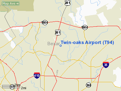
Location & QuickFacts
| FAA Information Effective: | 2008-09-25 |
| Airport Identifier: | T94 |
| Airport Status: | Operational |
| Longitude/Latitude: | 098-28-06.2010W/29-34-12.6730N
-98.468389/29.570187 (Estimated) |
| Elevation: | 873 ft / 266.09 m (Estimated) |
| Land: | 9 acres |
| From nearest city: | 3 nautical miles N of San Antonio, TX |
| Location: | Bexar County, TX |
| Magnetic Variation: | 07E (1985) |
Owner & Manager
| Ownership: | Privately owned |
| Owner: | Twin Oaks Air Park |
| Address: | 630 Heimer Rd
San Antonio, TX 78232 |
| Phone number: | 210-494-3928 |
| Manager: | W. A. Fowler, Jr. |
| Address: | 630 Heimer Rd
San Antonio, TX 78232 |
| Phone number: | 210-494-3928 |
Airport Operations and Facilities
| Airport Use: | Open to public |
| Wind indicator: | Yes |
| Segmented Circle: | No |
| Control Tower: | No |
| Landing fee charge: | No |
| Sectional chart: | San Antonio |
| Region: | ASW - Southwest |
| Boundary ARTCC: | ZHU - Houston |
| Tie-in FSS: | SJT - San Angelo |
| FSS on Airport: | No |
| FSS Toll Free: | 1-800-WX-BRIEF
FOR LOCAL CALL TO FSS 826-9561. |
| NOTAMs Facility: | SJT (NOTAM-d service avaliable) |
Airport Communications
Airport Services
| Fuel available: | 100LL
FOR FUEL AVAILABILITY CALL 210-494-3928. |
| Airframe Repair: | MINOR |
| Power Plant Repair: | MINOR |
| Bulk Oxygen: | NONE |
Runway Information
Runway 12/30
| Dimension: | 2225 x 30 ft / 678.2 x 9.1 m |
| Surface: | ASPH-TURF, Good Condition
TURF 140 FT SE END. |
| Weight Limit: | Single wheel: 4000 lbs. |
| |
Runway 12 |
Runway 30 |
| Traffic Pattern: | Left | Left |
| Markings: | Nonstandard, Poor Condition
NUMBERS BADLY FADED. | Nonstandard, Good Condition
RY NUMBERS 10 FT TALL. |
| Obstruction: | 30 ft trees, 200.0 ft from runway
+6 FT FENCE 30 FT L; ACCESS ROAD 50 FT R; BLDGS 60-100 FT L OF EXTDD CNTRLN; +30 FT TREE 17 FT FM RY END. | 6 ft fence, 0.0 ft from runway, 40 ft right of centerline |
|
Radio Navigation Aids
| ID |
Type |
Name |
Ch |
Freq |
Var |
Dist |
| CVB | NDB | Castroville | | 338.00 | 08E | 24.1 nm |
| ER | NDB | Shein | | 263.00 | 08E | 35.0 nm |
| HHH | NDB | Devine | | 359.00 | 07E | 35.8 nm |
| PEZ | NDB | Pleasanton | | 275.00 | 07E | 37.1 nm |
| HMA | NDB | Hondo | | 329.00 | 08E | 38.7 nm |
| DHK | TACAN | Randolph | 036X | | 09E | 10.7 nm |
| KSY | TACAN | Kelly | 057X | | 07E | 12.2 nm |
| SSF | VOR | Stinson | | 108.40 | 09E | 18.8 nm |
| HDO | VOR/DME | Hondo | 31X | 109.40 | 08E | 39.4 nm |
| SAT | VORTAC | San Antonio | 115X | 116.80 | 08E | 4.5 nm |
| RND | VORTAC | Randolph | 70X | 112.30 | 09E | 10.1 nm |
| STV | VORTAC | Stonewall | 085X | 113.80 | 08E | 40.2 nm |
| CSI | VORTAC | Center Point | 122X | 117.50 | 08E | 44.3 nm |
| SAT | VOT | San Antonio Intl | | 110.40 | | 2.2 nm |
Remarks
- HGRS, TREES, BLDGS WITHIN 50' OF RWY.
- RESIDENTAL HOUSES OBSTRUCT RY PRIM SFC NE OF RY.
- ARPT CLSD AT NIGHT TO TRANSIENT ACFT.
- WOODEN FENCE LCTD APRXLY 70 FT EAST OF RY ENTIRE LENGTH OF RY.
- MAY PREDATE THE ACT.
Images and information placed above are from
http://www.airport-data.com/airport/T94/
We thank them for the data!
| General Info
|
| Country |
United States
|
| State |
TEXAS
|
| FAA ID |
T94
|
| Latitude |
29-34-22.820N
|
| Longitude |
098-27-47.061W
|
| Elevation |
878 feet
|
| Near City |
SAN ANTONIO
|
We don't guarantee the information is fresh and accurate. The data may
be wrong or outdated.
For more up-to-date information please refer to other sources.
|
|


