 |
|
Location & QuickFacts
| FAA Information Effective: | 2008-09-25 |
| Airport Identifier: | TE22 |
| Airport Status: | Operational |
| Longitude/Latitude: | 096-48-00.0000W/32-48-00.0000N
-96.800000/32.800000 (Estimated) |
| Elevation: | 622 ft / 189.59 m (Estimated) |
| Land: | 15 acres |
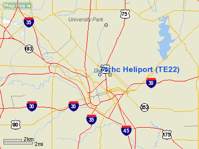
| From nearest city: | 0 nautical miles N of Dallas, TX |
| Location: | Dallas County, TX |
| Magnetic Variation: | 06E (1995) |
Owner & Manager
| Ownership: | Privately owned |
| Owner: | Tx Scottish Rite Hosp For Children |
| Address: | 2222 Welborn Street
Dallas, TX 75219 |
| Phone number: | 214-559-5000 |
| Manager: | David Bridges
ASSISTANT ADMINISTRATOR. |
| Address: | 2222 Welborn Street
Dallas, TX 75219 |
| Phone number: | 214-559-7609 |
Airport Operations and Facilities
| Airport Use: | Private
MEDICAL. |
| Segmented Circle: | No |
| Control Tower: | No |
| Sectional chart: | Dallas-ft Worth |
| Region: | ASW - Southwest |
| Boundary ARTCC: | ZFW - Fort Worth |
| Tie-in FSS: | FTW - Fort Worth |
| FSS Phone: | 817-541-3474 |
| FSS Toll Free: | 1-800-WX-BRIEF |
Runway Information
Helipad H1
| Dimension: | 48 x 48 ft / 14.6 x 14.6 m |
| Surface: | CONC,
RY H1 ROOFTOP. |
| |
Runway H1 |
Runway |
| Traffic Pattern: | Left | Left |
|
Radio Navigation Aids
| ID |
Type |
Name |
Ch |
Freq |
Var |
Dist |
| RBD | NDB | Redbird | | 287.00 | 06E | 8.2 nm |
| PQF | NDB | Mesquite | | 248.00 | 06E | 13.7 nm |
| LNC | NDB | Lancaster | | 239.00 | 06E | 13.9 nm |
| XQH | NDB | Cedar Hill | | 353.00 | 08E | 15.4 nm |
| JUG | NDB | Jecca | | 388.00 | 06E | 15.7 nm |
| AVZ | NDB | Travis | | 260.00 | 06E | 27.9 nm |
| MII | NDB | Caddo Mills | | 316.00 | 06E | 31.4 nm |
| SYW | NDB | Cash | | 428.00 | 05E | 38.6 nm |
| CGQ | NDB | Powell | | 344.00 | 06E | 48.1 nm |
| NFW | TACAN | Nas Jrb Fort Worth | 024X | | 07E | 32.4 nm |
| MJF | TACAN | Arvilla | 033X | | 05E | 40.6 nm |
| CVE | VOR/DME | Cowboy | 109X | 116.20 | 06E | 7.6 nm |
| TTT | VOR/DME | Maverick | 078X | 113.10 | 06E | 12.8 nm |
| FUZ | VORTAC | Ranger | 104X | 115.70 | 06E | 19.9 nm |
| CQY | VORTAC | Cedar Creek | 095X | 114.80 | 06E | 47.3 nm |
| DAL | VOT | Dallas Love Field | | 113.30 | | 3.9 nm |
| FTW | VOT | Fort Worth Meacham | | 108.20 | | 28.2 nm |
Images and information placed above are from
http://www.airport-data.com/airport/TE22/
We thank them for the data!
| General Info
|
| Country |
United States
|
| State |
TEXAS
|
| FAA ID |
TE22
|
| Latitude |
32-48-00.000N
|
| Longitude |
096-48-00.000W
|
| Elevation |
622 feet
|
| Near City |
DALLAS
|
We don't guarantee the information is fresh and accurate. The data may
be wrong or outdated.
For more up-to-date information please refer to other sources.
|
|


