 |
|
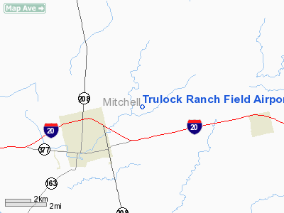
Trulock Ranch Field Airport |
Location & QuickFacts
| FAA Information Effective: | 2008-09-25 |
| Airport Identifier: | 7TE8 |
| Airport Status: | Operational |
| Longitude/Latitude: | 100-48-39.4060W/32-25-15.4250N
-100.810946/32.420951 (Estimated) |
| Elevation: | 2168 ft / 660.81 m (Estimated) |
| Land: | 30 acres |
| From nearest city: | 3 nautical miles NE of Colorado City, TX |
| Location: | Mitchell County, TX |
| Magnetic Variation: | 08E (1985) |
Owner & Manager
| Ownership: | Privately owned |
| Owner: | O B Trulock Jr |
| Address: | 1508 Dallas St
Colorado City, TX 79512 |
| Phone number: | 915-728-3428 |
| Manager: | O B Trulock Jr |
| Address: | 1508 Dallas St
Colorado City, TX 79512 |
| Phone number: | 915-728-3428 |
Airport Operations and Facilities
| Airport Use: | Private |
| Wind indicator: | Yes |
| Segmented Circle: | No |
| Control Tower: | No |
| Landing fee charge: | No |
| Sectional chart: | Dallas-ft Worth |
| Region: | ASW - Southwest |
| Boundary ARTCC: | ZFW - Fort Worth |
| Tie-in FSS: | FTW - Fort Worth |
| FSS on Airport: | No |
| FSS Phone: | 817-541-3474 |
| FSS Toll Free: | 1-800-WX-BRIEF |
Airport Services
| Airframe Repair: | NONE |
| Power Plant Repair: | NONE |
| Bottled Oxygen: | NONE |
| Bulk Oxygen: | NONE |
Runway Information
Runway 16/34
| Dimension: | 3000 x 60 ft / 914.4 x 18.3 m |
| Surface: | ASPH, Poor Condition |
| |
Runway 16 |
Runway 34 |
| Traffic Pattern: | Left | Left |
| Obstruction: | , 50:1 slope to clear | 45 ft ant, 1500.0 ft from runway, 200 ft right of centerline, 28:1 slope to clear |
|
Radio Navigation Aids
| ID |
Type |
Name |
Ch |
Freq |
Var |
Dist |
| SWW | NDB | Sweetwater | | 275.00 | 08E | 17.7 nm |
| SDR | NDB | Snyder | | 359.00 | 08E | 18.2 nm |
| DYS | TACAN | Dyess | 063X | | 08E | 48.4 nm |
| BGS | VORTAC | Big Spring | 090X | 114.30 | 11E | 34.2 nm |
| ABI | VORTAC | Abilene | 084X | 113.70 | 10E | 48.2 nm |
Images and information placed above are from
http://www.airport-data.com/airport/7TE8/
We thank them for the data!
| General Info
|
| Country |
United States
|
| State |
TEXAS
|
| FAA ID |
7TE8
|
| Latitude |
32-25-15.425N
|
| Longitude |
100-48-39.406W
|
| Elevation |
2168 feet
|
| Near City |
COLORADO CITY
|
We don't guarantee the information is fresh and accurate. The data may
be wrong or outdated.
For more up-to-date information please refer to other sources.
|
|


