 |
|
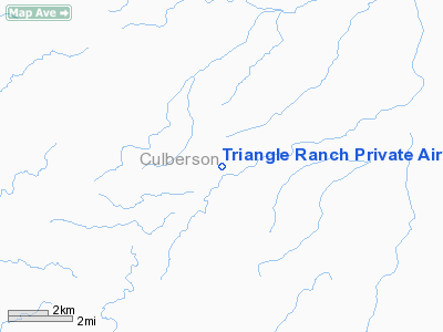
Triangle Ranch Private Airport |
Location & QuickFacts
| FAA Information Effective: | 2008-09-25 |
| Airport Identifier: | 2TA3 |
| Airport Status: | Operational |
| Longitude/Latitude: | 104-35-52.7850W/31-43-05.4380N
-104.597996/31.718177 (Estimated) |
| Elevation: | 4400 ft / 1341.12 m (Estimated) |
| Land: | 10 acres |
| From nearest city: | 14 nautical miles SE of Pine Springs, TX |
| Location: | Culberson County, TX |
| Magnetic Variation: | 10E (1985) |
Owner & Manager
| Ownership: | Privately owned |
| Owner: | M. C. Sibley Estate |
| Address: | 808 Preston Trail
Carlsbad, NM 88220 |
| Phone number: | 915-828-3214 |
| Manager: | John R Sibley |
| Address: | 808 Preston Trail
Carlsbad, NM 88220 |
| Phone number: | 915-828-3214
MOBIL NR. 6302. |
Airport Operations and Facilities
| Airport Use: | Private |
| Wind indicator: | No |
| Segmented Circle: | No |
| Control Tower: | No |
| Landing fee charge: | No |
| Sectional chart: | El Paso |
| Region: | ASW - Southwest |
| Boundary ARTCC: | ZAB - Albuquerque |
| Tie-in FSS: | ABQ - Albuquerque |
| FSS on Airport: | No |
| FSS Toll Free: | 1-800-WX-BRIEF |
Runway Information
Runway 08/26
| Dimension: | 2800 x 50 ft / 853.4 x 15.2 m |
| Surface: | TURF, |
| |
Runway 08 |
Runway 26 |
| Traffic Pattern: | Right | Right |
|
Runway 12/30
| Dimension: | 4000 x 50 ft / 1219.2 x 15.2 m |
| Surface: | TURF, |
| |
Runway 12 |
Runway 30 |
| Traffic Pattern: | Left | Left |
|
Radio Navigation Aids
| ID |
Type |
Name |
Ch |
Freq |
Var |
Dist |
| VHN | NDB | Van Horn | | 233.00 | 10E | 40.6 nm |
| SFL | VORTAC | Salt Flat | 077X | 113.00 | 12E | 25.1 nm |
| CNM | VORTAC | Carlsbad | 110X | 116.30 | 12E | 37.5 nm |
| HUP | VORTAC | Hudspeth | 097X | 115.00 | 12E | 40.8 nm |
Remarks
- LOW FLYING JET AIRCRAFT OVER RWY 12/30.
Images and information placed above are from
http://www.airport-data.com/airport/2TA3/
We thank them for the data!
| General Info
|
| Country |
United States
|
| State |
TEXAS
|
| FAA ID |
2TA3
|
| Latitude |
31-43-05.438N
|
| Longitude |
104-35-52.785W
|
| Elevation |
4400 feet
|
| Near City |
PINE SPRINGS
|
We don't guarantee the information is fresh and accurate. The data may
be wrong or outdated.
For more up-to-date information please refer to other sources.
|
|


