 |
|
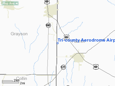
Tri-county Aerodrome Airport |
Location & QuickFacts
| FAA Information Effective: | 2008-09-25 |
| Airport Identifier: | 48TX |
| Airport Status: | Operational |
| Longitude/Latitude: | 096-22-53.9380W/33-27-15.3930N
-96.381649/33.454276 (Estimated) |
| Elevation: | 790 ft / 240.79 m (Estimated) |
| Land: | 66 acres |
| From nearest city: | 3 nautical miles NW of Trenton, TX |
| Location: | Fannin County, TX |
| Magnetic Variation: | 06E (1985) |
Owner & Manager
| Ownership: | Privately owned |
| Owner: | Tri-county Aerodrome, Inc. |
| Address: | Rt 2 Box 15
Whitewright, TX 75491 |
| Phone number: | 903-364-5103 |
| Manager: | Alfonz Trone |
| Address: | Rt 2 Box 15
Whitewright, TX 75491 |
| Phone number: | 903-364-5103 |
Airport Operations and Facilities
| Airport Use: | Private |
| Wind indicator: | Yes |
| Segmented Circle: | No |
| Control Tower: | No |
| Sectional chart: | Dallas-ft Worth |
| Region: | ASW - Southwest |
| Boundary ARTCC: | ZFW - Fort Worth |
| Tie-in FSS: | FTW - Fort Worth |
| FSS on Airport: | No |
| FSS Phone: | 817-541-3474 |
| FSS Toll Free: | 1-800-WX-BRIEF |
Airport Services
| Fuel available: | 100LLA MOGAS |
Runway Information
Runway 17/35
| Dimension: | 3900 x 150 ft / 1188.7 x 45.7 m |
| Surface: | TURF, |
| |
Runway 17 |
Runway 35 |
| Traffic Pattern: | Left | Left |
|
Radio Navigation Aids
| ID |
Type |
Name |
Ch |
Freq |
Var |
Dist |
| HJM | NDB | Rayburn | | 415.00 | 06E | 14.1 nm |
| MII | NDB | Caddo Mills | | 316.00 | 06E | 25.8 nm |
| DNI | NDB | Denison | | 341.00 | 06E | 26.5 nm |
| DUA | NDB | Durant | | 359.00 | 05E | 29.4 nm |
| SYW | NDB | Cash | | 428.00 | 05E | 32.5 nm |
| PQF | NDB | Mesquite | | 248.00 | 06E | 39.5 nm |
| AVZ | NDB | Travis | | 260.00 | 06E | 42.3 nm |
| GLE | NDB | Gainesville | | 330.00 | 06E | 43.9 nm |
| JUG | NDB | Jecca | | 388.00 | 06E | 47.9 nm |
| MJF | TACAN | Arvilla | 033X | | 05E | 28.3 nm |
| URH | VOR/DME | Texoma | 090X | 114.30 | 05E | 29.5 nm |
| CVE | VOR/DME | Cowboy | 109X | 116.20 | 06E | 42.9 nm |
| SLR | VOR/DME | Sulphur Springs | 027X | 109.00 | 08E | 44.9 nm |
| PRX | VOR/DME | Paris | 083X | 113.60 | 07E | 47.1 nm |
| TTT | VOR/DME | Maverick | 078X | 113.10 | 06E | 48.3 nm |
| BYP | VORTAC | Bonham | 093X | 114.60 | 06E | 8.9 nm |
| DAL | VOT | Dallas Love Field | | 113.30 | | 43.5 nm |
Remarks
- PARACHUTE JUMPING ACTIVITIES SR-SS, 7 DAYS WK. SFC 14,000 MSL.
Images and information placed above are from
http://www.airport-data.com/airport/48TX/
We thank them for the data!
| General Info
|
| Country |
United States
|
| State |
TEXAS
|
| FAA ID |
48TX
|
| Latitude |
33-27-15.393N
|
| Longitude |
096-22-53.938W
|
| Elevation |
790 feet
|
| Near City |
TRENTON
|
We don't guarantee the information is fresh and accurate. The data may
be wrong or outdated.
For more up-to-date information please refer to other sources.
|
|


