 |
|
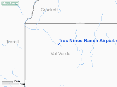
Location & QuickFacts
| FAA Information Effective: | 2008-09-25 |
| Airport Identifier: | XS36 |
| Airport Status: | Operational |
| Longitude/Latitude: | 101-41-29.8700W/30-15-12.7000N
-101.691631/30.253528 (Estimated) |
| Elevation: | 1690 ft / 515.11 m (Estimated) |
| Land: | 0 acres |
| From nearest city: | 12 nautical miles NN of Pandale, TX |
| Location: | Val Verde County, TX |
| Magnetic Variation: | () |
Owner & Manager
| Ownership: | Privately owned |
| Owner: | John B. Meadows |
| Address: | 9065 Jollyville Rd Suite 201
Austin, TX 78755 |
| Phone number: | 512-346-5774 |
| Manager: | John B. Meadows |
| Address: | 9065 Jollyville Rd Suite 201
Austin, TX 78755 |
| Phone number: | 512-346-5774 |
Airport Operations and Facilities
| Airport Use: | Private |
| Wind indicator: | Yes |
| Control Tower: | No |
| Sectional chart: | San Antonio |
| Region: | ASW - Southwest |
| Boundary ARTCC: | ZHU - Houston |
| Tie-in FSS: | SJT - San Angelo |
| FSS Toll Free: | 1-800-WX-BRIEF |
Runway Information
Runway 11/29
| Dimension: | 2000 x 50 ft / 609.6 x 15.2 m |
| Surface: | GRVL, |
| |
Runway 11 |
Runway 29 |
| Traffic Pattern: | Left | Left |
|
Radio Navigation Aids
| ID |
Type |
Name |
Ch |
Freq |
Var |
Dist |
Remarks
- PRVDD YOU NOTIFY THE AMGROF AVENGER FIELD THAT OF YOUR OPERATING PROCEDURES AND INGRESS AND EGRESS ROUTES.
Images and information placed above are from
http://www.airport-data.com/airport/XS36/
We thank them for the data!
| General Info
|
| Country |
United States
|
| State |
TEXAS
|
| FAA ID |
XS36
|
| Latitude |
28-41-05.973N
|
| Longitude |
096-19-30.891W
|
| Elevation |
15 feet
|
| Near City |
PALACIOS
|
We don't guarantee the information is fresh and accurate. The data may
be wrong or outdated.
For more up-to-date information please refer to other sources.
|
|


