 |
|
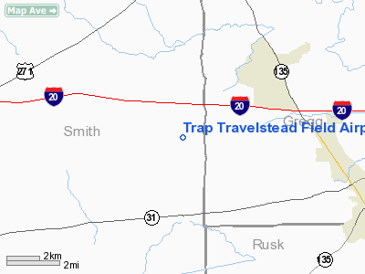
Trap Travelstead Field Airport |
Location & QuickFacts
| FAA Information Effective: | 2008-09-25 |
| Airport Identifier: | 98TS |
| Airport Status: | Operational |
| Longitude/Latitude: | 095-00-00.7870W/32-25-05.5340N
-95.000219/32.418204 (Estimated) |
| Elevation: | 430 ft / 131.06 m (Estimated) |
| Land: | 0 acres |
| From nearest city: | 10 nautical miles NE of Winona, TX |
| Location: | Smith County, TX |
| Magnetic Variation: | 06E (1985) |
Owner & Manager
| Ownership: | Privately owned |
| Owner: | R.l. Heinrich |
| Address: | Po Box 3498
Baytown, TX 77520 |
| Manager: | J.e. Willis Jr |
| Address: | Rt 25 Box 954
Tyler, TX 75707 |
| Phone number: | 214-581-4100 |
Airport Operations and Facilities
| Airport Use: | Private |
| Segmented Circle: | No |
| Control Tower: | No |
| Sectional chart: | Dallas-ft Worth |
| Region: | ASW - Southwest |
| Boundary ARTCC: | ZFW - Fort Worth |
| Tie-in FSS: | FTW - Fort Worth |
| FSS Phone: | 817-541-3474 |
| FSS Toll Free: | 1-800-WX-BRIEF
LOCAL CALL TO FSS 624-8471. |
Runway Information
Runway 06/24
| Dimension: | 1800 x 600 ft / 548.6 x 182.9 m |
| Surface: | TURF, |
| |
Runway 06 |
Runway 24 |
| Traffic Pattern: | Left | Left |
|
Runway 17/35
| Dimension: | 1900 x 800 ft / 579.1 x 243.8 m |
| Surface: | TURF, |
| |
Runway 17 |
Runway 35 |
| Traffic Pattern: | Left | Left |
|
Runway 18/36
| Dimension: | 1000 x 1000 ft / 304.8 x 304.8 m |
| Surface: | TURF, |
| |
Runway 18 |
Runway 36 |
| Traffic Pattern: | Left | Left |
|
Radio Navigation Aids
| ID |
Type |
Name |
Ch |
Freq |
Var |
Dist |
| ABG | NDB | Ambassador | | 404.00 | 07E | 11.6 nm |
| HNO | NDB | Henderson | | 371.00 | 06E | 15.5 nm |
| TY | NDB | Tyler | | 320.00 | 06E | 23.8 nm |
| LST | NDB | Lone Star | | 305.00 | 05E | 33.3 nm |
| JSO | NDB | Cherokee County | | 263.00 | 05E | 34.7 nm |
| RPF | NDB | Carthage | | 332.00 | 04E | 38.5 nm |
| AHX | NDB | Athens | | 269.00 | 06E | 45.0 nm |
| GXD | NDB | Nacogdoches | | 391.00 | 05E | 48.6 nm |
| TYR | VOR/DME | Tyler | 089X | 114.20 | 06E | 20.8 nm |
| UIM | VOR/DME | Quitman | 087X | 114.00 | 08E | 33.4 nm |
| FZT | VOR/DME | Frankston | 051X | 111.40 | 06E | 34.0 nm |
| GGG | VORTAC | Gregg County | 070X | 112.30 | 07E | 12.5 nm |
Remarks
- PROVIDED THRS ARE DSPLCD TO PROVIDE A 20:1 GLIDE SLOPE.
Images and information placed above are from
http://www.airport-data.com/airport/98TS/
We thank them for the data!
| General Info
|
| Country |
United States
|
| State |
TEXAS
|
| FAA ID |
98TS
|
| Latitude |
32-25-05.534N
|
| Longitude |
095-00-00.787W
|
| Elevation |
430 feet
|
| Near City |
WINONA
|
We don't guarantee the information is fresh and accurate. The data may
be wrong or outdated.
For more up-to-date information please refer to other sources.
|
|


