 |
|
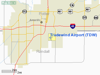
Location & QuickFacts
| FAA Information Effective: | 2008-09-25 |
| Airport Identifier: | TDW |
| Airport Status: | Operational |
| Longitude/Latitude: | 101-49-33.1000W/35-10-11.6000N
-101.825861/35.169889 (Estimated) |
| Elevation: | 3649 ft / 1112.22 m (Surveyed) |
| Land: | 595 acres |
| From nearest city: | 3 nautical miles SE of Amarillo, TX |
| Location: | Randall County, TX |
| Magnetic Variation: | 08E (2000) |
Owner & Manager
| Ownership: | Privately owned |
| Owner: | Tradewind Llc |
| Address: | 4105 Tradewind Rd.
Amarillo, TX 79118 |
| Phone number: | 806-376-1008 |
| Manager: | Les Byram |
| Address: | 4105 Tradewind Road
Amarillo, TX 79118 |
| Phone number: | 806-376-1008 |
Airport Operations and Facilities
| Airport Use: | Open to public |
| Wind indicator: | Yes |
| Segmented Circle: | Yes |
| Control Tower: | No |
| Lighting Schedule: | DUSK-DAWN
ACTVT MIRL RYS 05/23 & 17/35 - CTAF. |
| Beacon Color: | Clear-Green (lighted land airport) |
| Landing fee charge: | No |
| Sectional chart: | Dallas-ft Worth |
| Region: | ASW - Southwest |
| Traffic Pattern Alt: | 1000 ft |
| Boundary ARTCC: | ZAB - Albuquerque |
| Tie-in FSS: | FTW - Fort Worth |
| FSS on Airport: | No |
| FSS Phone: | 817-541-3474 |
| FSS Toll Free: | 1-800-WX-BRIEF |
| NOTAMs Facility: | FTW (NOTAM-d service avaliable) |
| Federal Agreements: | 1MY |
Airport Communications
| CTAF: | 122.800 |
| Unicom: | 122.800 |
Airport Services
| Fuel available: | 100LLA1+ |
| Airframe Repair: | MAJOR |
| Power Plant Repair: | MAJOR |
| Bottled Oxygen: | HIGH |
Runway Information
Runway 05/23
| Dimension: | 3000 x 60 ft / 914.4 x 18.3 m |
| Surface: | ASPH, Good Condition |
| Weight Limit: | Single wheel: 20000 lbs. |
| Edge Lights: | Medium |
| |
Runway 05 |
Runway 23 |
| Longitude: | 101-49-44.5829W | 101-49-14.6788W |
| Latitude: | 35-09-55.8227N | 35-10-12.4595N |
| Elevation: | 3643.00 ft | 3627.00 ft |
| Alignment: | 56 | 127 |
| Traffic Pattern: | Left | Right |
| Markings: | Basic, Poor Condition
RY 05/23 NBRS FADED, NO CNTRLN. | Basic, Good Condition |
| Obstruction: | 4 ft fence, 200.0 ft from runway, 160 ft right of centerline
+4 FT FENCE 162 FT RIGHT CNTRLN AT THLD. | , 50:1 slope to clear |
|
Runway 17/35
| Dimension: | 5098 x 60 ft / 1553.9 x 18.3 m |
| Surface: | ASPH, Good Condition |
| Weight Limit: | Single wheel: 16000 lbs. |
| Edge Lights: | Medium |
| |
Runway 17 |
Runway 35 |
| Longitude: | 101-49-35.1907W | 101-49-35.0579W |
| Latitude: | 35-10-41.1412N | 35-09-50.7285N |
| Elevation: | 3648.00 ft | 3639.00 ft |
| Alignment: | 127 | 127 |
| Traffic Pattern: | Right | Left |
| Markings: | Basic, Good Condition
NO CNTRLN STRIPE. | Non-precision instrument, Good Condition |
| Crossing Height: | 25.00 ft | 0.00 ft |
| Displaced threshold: | 290.00 ft | 289.00 ft |
| VASI: | pulsating/steady burning on left side | |
| Visual Glide Angle: | 3.00° | 0.00° |
| Runway End Identifier: | Yes | Yes |
| Obstruction: | 6 ft fence, 200.0 ft from runway, 136 ft right of centerline
APCH RATIO FOR THE ROAD 10:1 FM DSPLCD THLD; 40 FT PLINE 400 FT FM THLD 260 FT R.
+4 FT FENCE AT RY END 0B; ROAD AT 52 FT. | 35 ft trees, 200.0 ft from runway, 150 ft left of centerline
APCH RATIO 5:1 FM DSPLCD THLD.
+4 FT FENCE AT RY END 0B; ROAD AT 50 FT. |
|
Helipad H1
| Dimension: | 50 x 50 ft / 15.2 x 15.2 m |
| Surface: | ASPH, Good Condition |
| |
Runway H1 |
Runway |
| Traffic Pattern: | Left | Left |
|
Radio Navigation Aids
| ID |
Type |
Name |
Ch |
Freq |
Var |
Dist |
| AM | NDB | Pande | | 251.00 | 09E | 1.7 nm |
| HRX | NDB | Hereford | | 341.00 | 09E | 30.9 nm |
| DUX | NDB | Durrett | | 414.00 | 09E | 42.7 nm |
| PPA | NDB | Pampa | | 368.00 | 09E | 48.8 nm |
| PNH | VORTAC | Panhandle | 113X | 116.60 | 08E | 7.4 nm |
| BGD | VORTAC | Borger | 023X | 108.60 | 11E | 44.0 nm |
Remarks
- RY 05/23 PERIMETER FENCE OBSTRUCTS PRIM SFC.
- RY 17/35 PERIMETER FENCE OBSTRUCTS PRIM SFC.
- HOUSING AND SCHOOL SURROUNDS RY 23 END.
Images and information placed above are from
http://www.airport-data.com/airport/TDW/
We thank them for the data!
| General Info
|
| Country |
United States
|
| State |
TEXAS
|
| FAA ID |
TDW
|
| Latitude |
35-10-11.591N
|
| Longitude |
101-49-33.171W
|
| Elevation |
3648 feet
|
| Near City |
AMARILLO
|
We don't guarantee the information is fresh and accurate. The data may
be wrong or outdated.
For more up-to-date information please refer to other sources.
|
|


