 |
|
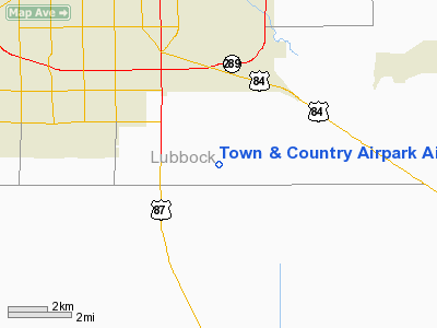
Town & Country Airpark Airport |
Location & QuickFacts
| FAA Information Effective: | 2008-09-25 |
| Airport Identifier: | F82 |
| Airport Status: | Operational |
| Longitude/Latitude: | 101-48-45.5880W/33-29-08.3130N
-101.812663/33.485642 (Estimated) |
| Elevation: | 3200 ft / 975.36 m (Surveyed) |
| Land: | 42 acres |
| From nearest city: | 5 nautical miles S of Lubbock, TX |
| Location: | Lubbock County, TX |
| Magnetic Variation: | 09E (1985) |
Owner & Manager
| Ownership: | Privately owned |
| Owner: | S.l. Horizon Llc. |
| Address: | 12201 County Rd. 2500
Lubbock, TX 79404 |
| Phone number: | 806-745-4967 |
| Manager: | Larry Graham |
| Address: | 12201 County Rd. 2500
Lubbock, TX 79404 |
| Phone number: | 806-745-4967
EMERGENCY 806-778-8819. |
Airport Operations and Facilities
| Airport Use: | Open to public |
| Wind indicator: | Yes |
| Segmented Circle: | No |
| Control Tower: | No |
| Lighting Schedule: | DUSK-DAWN
LIRL RY 17/35 PRESET LOW INTST; TO INCR INTST ACTVT - CTAF. |
| Beacon Color: | Clear-Green (lighted land airport) |
| Landing fee charge: | No |
| Sectional chart: | Dallas-ft Worth |
| Region: | ASW - Southwest |
| Traffic Pattern Alt: | 1000 ft |
| Boundary ARTCC: | ZFW - Fort Worth |
| Tie-in FSS: | FTW - Fort Worth |
| FSS on Airport: | No |
| FSS Phone: | 817-541-3474 |
| FSS Toll Free: | 1-800-WX-BRIEF |
| NOTAMs Facility: | FTW (NOTAM-d service avaliable) |
Airport Communications
| CTAF: | 122.800 |
| Unicom: | 122.800 |
Airport Services
| Fuel available: | 100LLA
FUEL AVBL 24 HRS WITH MAJOR CREDIT CARD. |
| Airframe Repair: | MAJOR |
| Power Plant Repair: | MAJOR |
| Bottled Oxygen: | NONE |
| Bulk Oxygen: | NONE |
Runway Information
Runway 07/25
| Dimension: | 1500 x 110 ft / 457.2 x 33.5 m |
| Surface: | TURF, Fair Condition |
| |
Runway 07 |
Runway 25 |
| Traffic Pattern: | Left | Left |
| Obstruction: | 40 ft pline, 1400.0 ft from runway, 35:1 slope to clear | 3 ft posts, 0.0 ft from runway, 50L/ ft right of centerline |
|
Runway 17/35
| Dimension: | 3500 x 70 ft / 1066.8 x 21.3 m |
| Surface: | ASPH, |
| Weight Limit: | Single wheel: 13000 lbs. |
| Edge Lights: | Low |
| |
Runway 17 |
Runway 35 |
| Traffic Pattern: | Left | Left |
| Markings: | Basic, Good Condition | Basic, Good Condition |
|
Radio Navigation Aids
| ID |
Type |
Name |
Ch |
Freq |
Var |
Dist |
| BFE | NDB | Brownfield | | 311.00 | 09E | 26.5 nm |
| LLN | NDB | Levelland | | 266.00 | 09E | 28.5 nm |
| CZX | NDB | Crosbyton | | 332.00 | 09E | 29.9 nm |
| LIU | NDB | Littlefield | | 212.00 | 10E | 38.8 nm |
| LSA | NDB | Lamesa | | 338.00 | 09E | 44.0 nm |
| PVW | VOR/DME | Plainview | 076X | 112.90 | 11E | 36.1 nm |
| LBB | VORTAC | Lubbock | 029X | 109.20 | 11E | 14.1 nm |
Remarks
- FARM EQUIPMENT OPERS APCH END RYS 17; 25 & 35.
Images and information placed above are from
http://www.airport-data.com/airport/F82/
We thank them for the data!
| General Info
|
| Country |
United States
|
| State |
TEXAS
|
| FAA ID |
F82
|
| Latitude |
33-29-08.313N
|
| Longitude |
101-48-45.588W
|
| Elevation |
3200 feet
|
| Near City |
LUBBOCK
|
We don't guarantee the information is fresh and accurate. The data may
be wrong or outdated.
For more up-to-date information please refer to other sources.
|
|


