 |
|
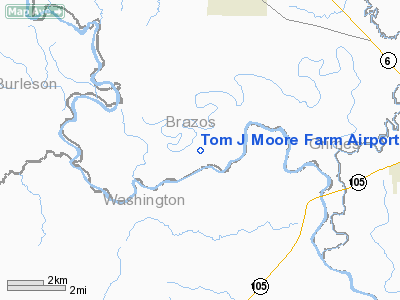
Location & QuickFacts
| FAA Information Effective: | 2008-09-25 |
| Airport Identifier: | XS18 |
| Airport Status: | Operational |
| Longitude/Latitude: | 096-13-28.8570W/30-23-04.7460N
-96.224683/30.384652 (Estimated) |
| Elevation: | 198 ft / 60.35 m (Estimated) |
| Land: | 0 acres |
| From nearest city: | 5 nautical miles S of Millican, TX |
| Location: | Brazos County, TX |
| Magnetic Variation: | 06E (1985) |
Owner & Manager
| Ownership: | Privately owned |
| Owner: | Tom J Moore |
| Address: | Box 1417
Navasota, TX 77868 |
| Phone number: | 713-825-3235 |
| Manager: | Tom J Moore |
| Address: | Box 1417
Navasota, TX 77868 |
| Phone number: | 713-825-3235 |
Airport Operations and Facilities
| Airport Use: | Private |
| Wind indicator: | No |
| Segmented Circle: | No |
| Control Tower: | No |
| Landing fee charge: | No |
| Sectional chart: | Houston |
| Region: | ASW - Southwest |
| Boundary ARTCC: | ZHU - Houston |
| Tie-in FSS: | CXO - Montgomery County |
| FSS on Airport: | No |
| FSS Toll Free: | 1-800-WX-BRIEF |
Airport Services
| Airframe Repair: | NONE |
| Power Plant Repair: | NONE |
Runway Information
Runway 17/35
| Dimension: | 4000 x 150 ft / 1219.2 x 45.7 m |
| Surface: | TURF, |
| |
Runway 17 |
Runway 35 |
| Traffic Pattern: | Left | Left |
|
Radio Navigation Aids
| ID |
Type |
Name |
Ch |
Freq |
Var |
Dist |
| BNH | NDB | Brenham | | 362.00 | 06E | 12.4 nm |
| DWH | NDB | David Hooks | | 521.00 | 05E | 37.6 nm |
| UTS | NDB | Huntsville | | 308.00 | 06E | 39.2 nm |
| EYQ | NDB | Weiser | | 286.00 | 06E | 40.7 nm |
| GYB | NDB | Lee County | | 385.00 | 07E | 41.2 nm |
| LYD | NDB | Lakeside | | 249.00 | 05E | 44.5 nm |
| ELA | VOR/DME | Eagle Lake | 111X | 116.40 | 08E | 43.7 nm |
| TNV | VORTAC | Navasota | 106X | 115.90 | 08E | 10.4 nm |
| CLL | VORTAC | College Station | 080X | 113.30 | 08E | 16.7 nm |
| IDU | VORTAC | Industry | 039X | 110.20 | 08E | 31.2 nm |
| LOA | VORTAC | Leona | 045X | 110.80 | 08E | 46.4 nm |
Images and information placed above are from
http://www.airport-data.com/airport/XS18/
We thank them for the data!
| General Info
|
| Country |
United States
|
| State |
TEXAS
|
| FAA ID |
XS18
|
| Latitude |
30-23-04.746N
|
| Longitude |
096-13-28.857W
|
| Elevation |
198 feet
|
| Near City |
MILLICAN
|
We don't guarantee the information is fresh and accurate. The data may
be wrong or outdated.
For more up-to-date information please refer to other sources.
|
|


