 |
|
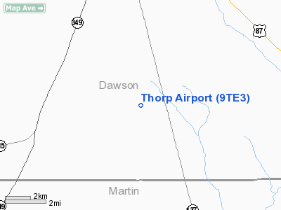
Location & QuickFacts
| FAA Information Effective: | 2008-09-25 |
| Airport Identifier: | 9TE3 |
| Airport Status: | Operational |
| Longitude/Latitude: | 101-55-51.5410W/32-34-40.3790N
-101.930984/32.577883 (Estimated) |
| Elevation: | 2900 ft / 883.92 m (Estimated) |
| Land: | 0 acres |
| From nearest city: | 10 nautical miles S of Lamesa, TX |
| Location: | Dawson County, TX |
| Magnetic Variation: | 09E (1985) |
Owner & Manager
| Ownership: | Privately owned |
| Owner: | Elton Thorp |
| Address: | Rr01, Box 340
Lamesa, TX 79331 |
| Phone number: | 806-462-7398 |
| Manager: | Elton Thorp |
| Address: | Rr01, Box 340
Lamesa, TX 79331 |
| Phone number: | 806-462-7398 |
Airport Operations and Facilities
| Airport Use: | Private |
| Wind indicator: | No |
| Segmented Circle: | No |
| Control Tower: | No |
| Landing fee charge: | No |
| Sectional chart: | Albuquerque |
| Region: | ASW - Southwest |
| Traffic Pattern Alt: | 800 ft |
| Boundary ARTCC: | ZFW - Fort Worth |
| Tie-in FSS: | FTW - Fort Worth |
| FSS on Airport: | No |
| FSS Phone: | 817-541-3474 |
| FSS Toll Free: | 1-800-WX-BRIEF |
Airport Services
| Fuel available: | 100 |
| Airframe Repair: | NONE |
| Power Plant Repair: | NONE |
Runway Information
Runway 15/33
| Dimension: | 2600 x 40 ft / 792.5 x 12.2 m |
| Surface: | DIRT, |
| |
Runway 15 |
Runway 33 |
| Traffic Pattern: | Left | Left |
|
Radio Navigation Aids
| ID |
Type |
Name |
Ch |
Freq |
Var |
Dist |
| LSA | NDB | Lamesa | | 338.00 | 09E | 10.9 nm |
| ANR | NDB | Andrews | | 245.00 | 09E | 33.6 nm |
| GNC | NDB | Gaines County | | 344.00 | 09E | 36.6 nm |
| BFE | NDB | Brownfield | | 311.00 | 09E | 38.5 nm |
| MA | NDB | Farly | | 326.00 | 09E | 40.7 nm |
| BGS | VORTAC | Big Spring | 090X | 114.30 | 11E | 25.5 nm |
| MAF | VORTAC | Midland | 095X | 114.80 | 11E | 36.6 nm |
| MAF | VOT | Midland International | | 108.20 | | 41.0 nm |
Images and information placed above are from
http://www.airport-data.com/airport/9TE3/
We thank them for the data!
| General Info
|
| Country |
United States
|
| State |
TEXAS
|
| FAA ID |
9TE3
|
| Latitude |
32-34-40.379N
|
| Longitude |
101-55-51.541W
|
| Elevation |
2900 feet
|
| Near City |
LAMESA
|
We don't guarantee the information is fresh and accurate. The data may
be wrong or outdated.
For more up-to-date information please refer to other sources.
|
|


