 |
|
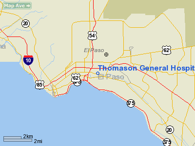
Thomason General Hospital Heliport |
Location & QuickFacts
| FAA Information Effective: | 2008-09-25 |
| Airport Identifier: | TA41 |
| Airport Status: | Operational |
| Longitude/Latitude: | 106-26-05.9470W/31-46-19.3900N
-106.434985/31.772053 (Estimated) |
| Elevation: | 3701 ft / 1128.06 m (Estimated) |
| Land: | 2 acres |
| From nearest city: | 0 nautical miles N of El Paso, TX |
| Location: | El Paso County, TX |
| Magnetic Variation: | 11E (1985) |
Owner & Manager
| Ownership: | Privately owned |
| Owner: | R.e. Thomason General Hosp. |
| Address: | 4815 Alameda Ave.
El Paso, TX 79905 |
| Phone number: | 915-544-1200
EXT 130. |
| Manager: | Director Of Engineering |
| Address: | 4815 Alameda Ave.
El Paso, TX 79905 |
| Phone number: | 915-544-1200 |
Airport Operations and Facilities
| Airport Use: | Private
MEDICAL. |
| Wind indicator: | Yes |
| Segmented Circle: | No |
| Control Tower: | No |
| Lighting Schedule: | PHONE REQ
FOR ROTG BCN & PERIMETER LGTS CALL 915-544-1200 EXT 130. |
| Beacon Color: | Clear-Green-Yellow (heliport) |
| Sectional chart: | El Paso |
| Region: | ASW - Southwest |
| Boundary ARTCC: | ZAB - Albuquerque |
| Tie-in FSS: | ABQ - Albuquerque |
| FSS on Airport: | No |
| FSS Toll Free: | 1-800-WX-BRIEF |
Runway Information
Helipad H1
| Dimension: | 60 x 60 ft / 18.3 x 18.3 m |
| Surface: | ASPH, |
| |
Runway H1 |
Runway |
| Traffic Pattern: | Left | Left |
|
Radio Navigation Aids
| ID |
Type |
Name |
Ch |
Freq |
Var |
Dist |
| EL | NDB | Valtr | | 242.00 | 11E | 8.0 nm |
| CJS | VOR/DME | Ciudad Juarez | 114X | 116.70 | 11E | 8.2 nm |
| ELP | VORTAC | El Paso | 099X | 115.20 | 12E | 8.3 nm |
| EWM | VORTAC | Newman | 071X | 112.40 | 12E | 13.6 nm |
| ELP | VOT | El Paso Intl | | 111.00 | | 3.2 nm |
Remarks
- PRVDD LGT STDS N & W OF HELIPAD CONFORM TO THE 8:1 HGT/DISTANCE RECOMMENDED FOR APCH AREAS.
Images and information placed above are from
http://www.airport-data.com/airport/TA41/
We thank them for the data!
| General Info
|
| Country |
United States
|
| State |
TEXAS
|
| FAA ID |
TA41
|
| Latitude |
31-46-19.390N
|
| Longitude |
106-26-05.947W
|
| Elevation |
3701 feet
|
| Near City |
EL PASO
|
We don't guarantee the information is fresh and accurate. The data may
be wrong or outdated.
For more up-to-date information please refer to other sources.
|
|


