 |
|
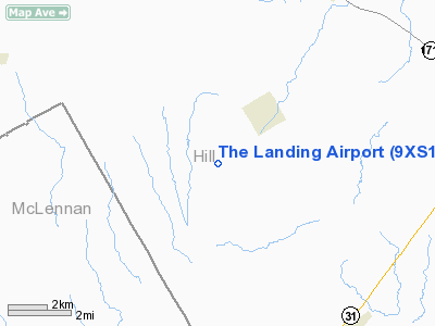
Location & QuickFacts
| FAA Information Effective: | 2008-09-25 |
| Airport Identifier: | 9XS1 |
| Airport Status: | Operational |
| Longitude/Latitude: | 096-57-10.0000W/31-50-08.0000N
-96.952778/31.835556 (Estimated) |
| Elevation: | 570 ft / 173.74 m (Estimated) |
| Land: | 0 acres |
| From nearest city: | 3 nautical miles W of Hill, TX |
| Location: | Hill County, TX |
| Magnetic Variation: | 06E (1995) |
Owner & Manager
| Ownership: | Privately owned |
| Owner: | The Landing Corp |
| Address: | 11226 Sagewind
Houston, TX 77089 |
| Phone number: | 281-481-0780 |
| Manager: | Clinton Burton |
| Address: | 11226 Sagewind
Houston, TX 77089 |
| Phone number: | 281-481-0780 |
Airport Operations and Facilities
| Airport Use: | Private |
| Segmented Circle: | No |
| Control Tower: | No |
| Sectional chart: | Houston |
| Region: | ASW - Southwest |
| Boundary ARTCC: | ZFW - Fort Worth |
| Tie-in FSS: | FTW - Fort Worth |
| FSS on Airport: | No |
| FSS Phone: | 817-541-3474 |
| FSS Toll Free: | 1-800-WX-BRIEF |
Runway Information
Runway 06/24
| Dimension: | 3044 x 100 ft / 927.8 x 30.5 m |
| Surface: | TURF, |
| |
Runway 06 |
Runway 24 |
| Traffic Pattern: | Left | Left |
| Obstruction: | | 4 ft fence, 0.0 ft from runway |
|
Radio Navigation Aids
| ID |
Type |
Name |
Ch |
Freq |
Var |
Dist |
| ROB | NDB | Robinson | | 400.00 | 07E | 20.8 nm |
| LXY | NDB | Mexia | | 329.00 | 07E | 25.4 nm |
| CGQ | NDB | Powell | | 344.00 | 06E | 30.1 nm |
| CRS | NDB | Corsicana | | 396.00 | 06E | 30.7 nm |
| PYF | NDB | Pyramid | | 418.00 | 06E | 38.6 nm |
| XQH | NDB | Cedar Hill | | 353.00 | 08E | 45.4 nm |
| LNC | NDB | Lancaster | | 239.00 | 06E | 46.1 nm |
| GNL | VOR/DME | Groesbeck | 025X | 108.80 | 05E | 25.7 nm |
| TPL | VOR/DME | Temple | 041X | 110.40 | 09E | 44.7 nm |
| ACT | VORTAC | Waco | 100X | 115.30 | 09E | 19.2 nm |
| CQY | VORTAC | Cedar Creek | 095X | 114.80 | 06E | 43.0 nm |
Remarks
- OWNER DESIRES ARPT NOT BE CHARTED.
Images and information placed above are from
http://www.airport-data.com/airport/9XS1/
We thank them for the data!
| General Info
|
| Country |
United States
|
| State |
TEXAS
|
| FAA ID |
9XS1
|
| Latitude |
31-50-08.000N
|
| Longitude |
096-57-10.000W
|
| Elevation |
570 feet
|
| Near City |
HILL
|
We don't guarantee the information is fresh and accurate. The data may
be wrong or outdated.
For more up-to-date information please refer to other sources.
|
|


