 |
|
Location & QuickFacts
| FAA Information Effective: | 2008-09-25 |
| Airport Identifier: | 92TX |
| Airport Status: | Operational |
| Longitude/Latitude: | 098-08-13.0320W/26-25-00.2420N
-98.136953/26.416734 (Estimated) |
| Elevation: | 92 ft / 28.04 m (Estimated) |
| Land: | 0 acres |
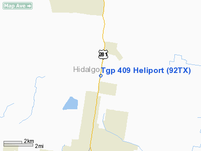
| From nearest city: | 8 nautical miles N of Edinburg, TX |
| Location: | Hidalgo County, TX |
| Magnetic Variation: | 07E (1990) |
Owner & Manager
| Ownership: | Privately owned |
| Owner: | Tennessee Gas Pipeline |
| Address: | 15415 Katy Freeway, Suite 100
Houston, TX 77094 |
| Phone number: | 713-492-8900 |
| Manager: | W.c. Byerly |
| Address: | 15415 Katy Freeway, Suite 100
Houston, TX 77094 |
| Phone number: | 713-578-4813 |
Airport Operations and Facilities
| Airport Use: | Private |
| Segmented Circle: | No |
| Control Tower: | No |
| Lighting Schedule: | PHONE REQ
FOR FLOOD LGTS CALL 713-578-4813. |
| Sectional chart: | Brownsville |
| Region: | ASW - Southwest |
| Boundary ARTCC: | ZHU - Houston |
| Tie-in FSS: | SJT - San Angelo |
| FSS on Airport: | No |
| FSS Toll Free: | 1-800-WX-BRIEF |
Runway Information
Helipad H1
| Dimension: | 100 x 100 ft / 30.5 x 30.5 m |
| Surface: | TURF, |
| |
Runway H1 |
Runway |
| Traffic Pattern: | Left | Left |
|
Radio Navigation Aids
| ID |
Type |
Name |
Ch |
Freq |
Var |
Dist |
| SNE | NDB | Santa Elena | | 260.00 | 07E | 29.8 nm |
| BKS | NDB | Brooks County | | 353.00 | 06E | 47.5 nm |
| REX | VOR | Reynosa | | 112.40 | 08E | 24.8 nm |
| MFE | VOR/DME | Mc Allen | 119X | 117.20 | 09E | 15.6 nm |
| HRL | VOR/DME | Harlingen | 029X | 109.20 | 05E | 28.5 nm |
Remarks
- PRVDD VFR & A WIND INDICATOR IS MAINTAINED THAT IS IN GOOD CONDITION.
Images and information placed above are from
http://www.airport-data.com/airport/92TX/
We thank them for the data!
| General Info
|
| Country |
United States
|
| State |
TEXAS
|
| FAA ID |
92TX
|
| Latitude |
26-25-00.242N
|
| Longitude |
098-08-13.032W
|
| Elevation |
92 feet
|
| Near City |
EDINBURG
|
We don't guarantee the information is fresh and accurate. The data may
be wrong or outdated.
For more up-to-date information please refer to other sources.
|
|


