 |
|
Location & QuickFacts
| FAA Information Effective: | 2008-09-25 |
| Airport Identifier: | 1TA1 |
| Airport Status: | Operational |
| Longitude/Latitude: | 094-08-15.6910W/30-59-03.7110N
-94.137692/30.984364 (Estimated) |
| Elevation: | 118 ft / 35.97 m (Estimated) |
| Land: | 0 acres |
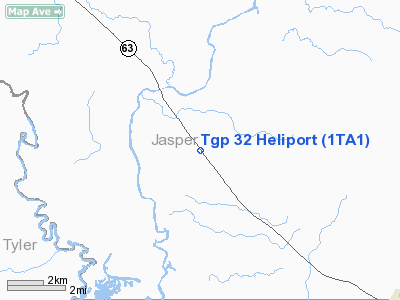
| From nearest city: | 10 nautical miles NW of Jasper, TX |
| Location: | Jasper County, TX |
| Magnetic Variation: | 05E (1990) |
Owner & Manager
| Ownership: | Privately owned |
| Owner: | Tennessee Gas Pipeline |
| Address: | Rt 3 Box 290
Houston, TX 77032 |
| Phone number: | 713-492-8900 |
| Manager: | P.e. Gray |
| Address: | 16951 Jfk Blvd
Jasper, TX 75951 |
| Phone number: | 713-757-8104 |
Airport Operations and Facilities
| Airport Use: | Private |
| Segmented Circle: | No |
| Control Tower: | No |
| Sectional chart: | Houston |
| Region: | ASW - Southwest |
| Boundary ARTCC: | ZHU - Houston |
| Tie-in FSS: | CXO - Montgomery County |
| FSS on Airport: | No |
| FSS Toll Free: | 1-800-WX-BRIEF |
Runway Information
Helipad H1
| Dimension: | 35 x 35 ft / 10.7 x 10.7 m |
| Surface: | CONC, |
| |
Runway H1 |
Runway |
| Traffic Pattern: | Left | Left |
|
Radio Navigation Aids
| ID |
Type |
Name |
Ch |
Freq |
Var |
Dist |
| POE1 | FAN MARKER | North | | | 07E | 47.9 nm |
| JAS | NDB | Jasper | | 344.00 | 04E | 5.7 nm |
| HRD | NDB | Hardin County | | 524.00 | 04E | 39.4 nm |
| VED | NDB | Leesville | | 247.00 | 04E | 41.6 nm |
| OC | NDB | Nados | | 253.00 | 05E | 42.5 nm |
| DR | NDB | Idder | | 385.00 | 04E | 43.7 nm |
| MMY | NDB | Many | | 272.00 | 04E | 46.7 nm |
| DQU | NDB | De Quincy | | 410.00 | 05E | 47.9 nm |
| GUV | NDB | Gator | | 359.00 | 05E | 49.2 nm |
| GXD | NDB | Nacogdoches | | 391.00 | 05E | 49.4 nm |
| LFK | VORTAC | Lufkin | 058X | 112.10 | 05E | 31.7 nm |
| FXU | VORTAC | Polk | 021X | 108.40 | 05E | 48.0 nm |
Images and information placed above are from
http://www.airport-data.com/airport/1TA1/
We thank them for the data!
| General Info
|
| Country |
United States
|
| State |
TEXAS
|
| FAA ID |
1TA1
|
| Latitude |
30-59-03.711N
|
| Longitude |
094-08-15.691W
|
| Elevation |
118 feet
|
| Near City |
JASPER
|
We don't guarantee the information is fresh and accurate. The data may
be wrong or outdated.
For more up-to-date information please refer to other sources.
|
|


