 |
|
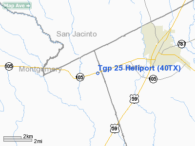
Location & QuickFacts
| FAA Information Effective: | 2008-09-25 |
| Airport Identifier: | 40TX |
| Airport Status: | Operational |
| Longitude/Latitude: | 095-09-41.7630W/30-19-18.7560N
-95.161601/30.321877 (Estimated) |
| Elevation: | 163 ft / 49.68 m (Estimated) |
| Land: | 0 acres |
| From nearest city: | 5 nautical miles W of Cleveland, TX |
| Location: | Montgomery County, TX |
| Magnetic Variation: | 05E (1990) |
Owner & Manager
| Ownership: | Privately owned |
| Owner: | Tennessee Gas Pipeline |
| Address: | Rt 2 Box 2000
Cleveland, TX 77327 |
| Phone number: | 713-492-8900 |
| Manager: | P.e. Gray |
| Address: | 16951 Jkf Blvd
Houston, TX 77032 |
| Phone number: | 713-757-8104 |
Airport Operations and Facilities
| Airport Use: | Private |
| Segmented Circle: | No |
| Control Tower: | No |
| Lighting Schedule: | PHONE REQ
FOR FLOOD LGTS CALL 713-492-8900. |
| Sectional chart: | Houston |
| Region: | ASW - Southwest |
| Boundary ARTCC: | ZHU - Houston |
| Tie-in FSS: | CXO - Montgomery County |
| FSS on Airport: | No |
| FSS Toll Free: | 1-800-WX-BRIEF |
Runway Information
Helipad H1
| Dimension: | 21 x 21 ft / 6.4 x 6.4 m |
| Surface: | CONC, |
| |
Runway H1 |
Runway |
| Traffic Pattern: | Left | Left |
|
Radio Navigation Aids
| ID |
Type |
Name |
Ch |
Freq |
Var |
Dist |
| BVP | NDB | Nixin | | 326.00 | 05E | 19.9 nm |
| DWH | NDB | David Hooks | | 521.00 | 05E | 24.1 nm |
| UTS | NDB | Huntsville | | 308.00 | 06E | 33.6 nm |
| EYQ | NDB | Weiser | | 286.00 | 06E | 34.1 nm |
| JPA | NDB | Sanjac | | 347.00 | 05E | 39.6 nm |
| LYD | NDB | Lakeside | | 249.00 | 05E | 40.5 nm |
| CBC | NDB | Anahuac | | 413.00 | 05E | 42.0 nm |
| HRD | NDB | Hardin County | | 524.00 | 04E | 46.8 nm |
| SGR | NDB | Hull | | 388.00 | 05E | 48.8 nm |
| EFD | TACAN | Ellington | 031X | | 05E | 43.0 nm |
| HUB | VOR/DME | Hobby | 118X | 117.10 | 05E | 40.5 nm |
| IAH | VORTAC | Humble | 113X | 116.60 | 05E | 23.9 nm |
| DAS | VORTAC | Daisetta | 116X | 116.90 | 05E | 28.0 nm |
| TNV | VORTAC | Navasota | 106X | 115.90 | 08E | 46.6 nm |
| HOU | VOT | Houston Wm P Hobby | | 108.40 | | 41.1 nm |
Images and information placed above are from
http://www.airport-data.com/airport/40TX/
We thank them for the data!
| General Info
|
| Country |
United States
|
| State |
TEXAS
|
| FAA ID |
40TX
|
| Latitude |
30-19-18.756N
|
| Longitude |
095-09-41.763W
|
| Elevation |
163 feet
|
| Near City |
CLEVELAND
|
We don't guarantee the information is fresh and accurate. The data may
be wrong or outdated.
For more up-to-date information please refer to other sources.
|
|


