 |
|
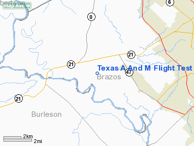
Texas A And M Flight Test Station Airport |
Location & QuickFacts
| FAA Information Effective: | 2008-09-25 |
| Airport Identifier: | 83TX |
| Airport Status: | Operational |
| Longitude/Latitude: | 096-29-00.8800W/30-38-00.7200N
-96.483578/30.633533 (Estimated) |
| Elevation: | 264 ft / 80.47 m (Estimated) |
| Land: | 0 acres |
| From nearest city: | 6 nautical miles W of Bryan, TX |
| Location: | Brazos County, TX |
| Magnetic Variation: | 06E (1985) |
Owner & Manager
| Ownership: | Privately owned |
| Owner: | Texas A & M University |
| Address: |
College Station, TX 77843-1244 |
| Phone number: | 409-845-6364 |
| Manager: | James Massey |
| Address: | Facilities Coordinator-tamu
College Station, TX 77843-1244 |
| Phone number: | 409-845-3835 |
Airport Operations and Facilities
| Airport Use: | Private |
| Wind indicator: | No |
| Segmented Circle: | No |
| Control Tower: | No |
| Landing fee charge: | No |
| Sectional chart: | Houston |
| Region: | ASW - Southwest |
| Boundary ARTCC: | ZHU - Houston |
| Tie-in FSS: | CXO - Montgomery County |
| FSS on Airport: | No |
| FSS Toll Free: | 1-800-WX-BRIEF
FOR FP FILING CALL CXO FSS 1-800-833-5602. |
Airport Services
| Airframe Repair: | NONE |
| Power Plant Repair: | NONE |
Runway Information
Runway 17R/35L
| Dimension: | 7000 x 150 ft / 2133.6 x 45.7 m |
| Surface: | CONC, |
| |
Runway 17R |
Runway 35L |
| Traffic Pattern: | Left | Left |
|
Radio Navigation Aids
| ID |
Type |
Name |
Ch |
Freq |
Var |
Dist |
| BNH | NDB | Brenham | | 362.00 | 06E | 25.4 nm |
| GYB | NDB | Lee County | | 385.00 | 07E | 37.9 nm |
| UTS | NDB | Huntsville | | 308.00 | 06E | 46.6 nm |
| CLL | VORTAC | College Station | 080X | 113.30 | 08E | 3.7 nm |
| TNV | VORTAC | Navasota | 106X | 115.90 | 08E | 30.3 nm |
| LOA | VORTAC | Leona | 045X | 110.80 | 08E | 39.7 nm |
| IDU | VORTAC | Industry | 039X | 110.20 | 08E | 40.9 nm |
Remarks
- CONTROL TWR & WATER TOWER EAST.
- FOUR ADDL RWYS ON FLD BUT ARE OBSTRUCTED.
- RWY 17R-35L OBSTRUCTED BY CARS & TRUCKS.
Images and information placed above are from
http://www.airport-data.com/airport/83TX/
We thank them for the data!
| General Info
|
| Country |
United States
|
| State |
TEXAS
|
| FAA ID |
83TX
|
| Latitude |
30-38-00.720N
|
| Longitude |
096-29-00.880W
|
| Elevation |
264 feet
|
| Near City |
BRYAN
|
We don't guarantee the information is fresh and accurate. The data may
be wrong or outdated.
For more up-to-date information please refer to other sources.
|
|


