 |
|
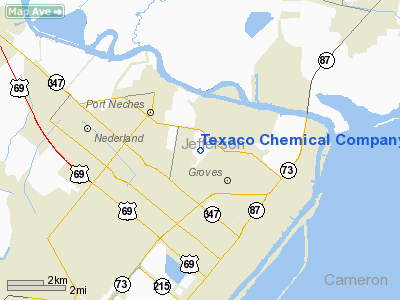
Texaco Chemical Company-east Heliport |
Location & QuickFacts
| FAA Information Effective: | 2008-09-25 |
| Airport Identifier: | 8TX5 |
| Airport Status: | Operational |
| Longitude/Latitude: | 093-55-55.6180W/29-57-44.7690N
-93.932116/29.962436 (Estimated) |
| Elevation: | 14 ft / 4.27 m (Estimated) |
| Land: | 0 acres |
| From nearest city: | 0 nautical miles N of Port Neches, TX |
| Location: | Jefferson County, TX |
| Magnetic Variation: | 05E (1985) |
Owner & Manager
| Ownership: | Privately owned |
| Owner: | Texaco Chemical Co. |
| Address: | 6001 Hwy 366
Port Neches, TX 77651 |
| Phone number: | 409-724-4543 |
| Manager: | Chad R. Wyble, Elec. Engineer |
| Address: | 6001 Hwy 366
Port Neches, TX 77651 |
| Phone number: | 409-724-4543 |
Airport Operations and Facilities
| Airport Use: | Private |
| Segmented Circle: | No |
| Control Tower: | No |
| Sectional chart: | Houston |
| Region: | ASW - Southwest |
| Boundary ARTCC: | ZHU - Houston |
| Tie-in FSS: | CXO - Montgomery County |
| FSS on Airport: | No |
| FSS Toll Free: | 1-800-WX-BRIEF |
Runway Information
Helipad H1
| Dimension: | 20 x 20 ft / 6.1 x 6.1 m |
| Surface: | CONC, |
| |
Runway H1 |
Runway |
| Traffic Pattern: | Left | Left |
|
Radio Navigation Aids
| ID |
Type |
Name |
Ch |
Freq |
Var |
Dist |
| ORG | NDB | Orange | | 211.00 | 05E | 9.6 nm |
| GDE | NDB | Goodhue | | 368.00 | 07E | 15.5 nm |
| HRD | NDB | Hardin County | | 524.00 | 04E | 28.3 nm |
| UX | NDB | Sulfy | | 278.00 | 04E | 30.2 nm |
| DQU | NDB | De Quincy | | 410.00 | 05E | 37.3 nm |
| CBC | NDB | Anahuac | | 413.00 | 05E | 39.7 nm |
| BPT | VOR/DME | Beaumont | 092X | 114.50 | 07E | 4.5 nm |
| SBI | VOR/DME | Sabine Pass | 101X | 115.40 | 07E | 17.5 nm |
| MHF | VOR/DME | Trinity | 083X | 113.60 | 07E | 49.4 nm |
| DAS | VORTAC | Daisetta | 116X | 116.90 | 05E | 39.5 nm |
| LCH | VORTAC | Lake Charles | 081X | 113.40 | 07E | 44.3 nm |
Images and information placed above are from
http://www.airport-data.com/airport/8TX5/
We thank them for the data!
| General Info
|
| Country |
United States
|
| State |
TEXAS
|
| FAA ID |
8TX5
|
| Latitude |
29-57-44.769N
|
| Longitude |
093-55-55.618W
|
| Elevation |
14 feet
|
| Near City |
PORT NECHES
|
We don't guarantee the information is fresh and accurate. The data may
be wrong or outdated.
For more up-to-date information please refer to other sources.
|
|


