 |
|
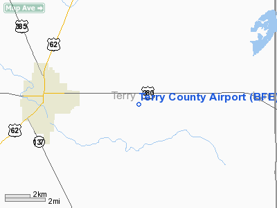
Location & QuickFacts
| FAA Information Effective: | 2008-09-25 |
| Airport Identifier: | BFE |
| Airport Status: | Operational |
| Longitude/Latitude: | 102-11-34.5191W/33-10-23.3160N
-102.192922/33.173143 (Estimated) |
| Elevation: | 3264 ft / 994.87 m (Surveyed) |
| Land: | 320 acres |
| From nearest city: | 4 nautical miles E of Brownfield, TX |
| Location: | Terry County, TX |
| Magnetic Variation: | 09E (1995) |
Owner & Manager
| Ownership: | Publicly owned |
| Owner: | Terry County |
| Address: | Terry Co Courthouse
Brownfield, TX 79316 |
| Phone number: | 806-637-6421 |
| Manager: | R.d. (pete) Harris |
| Address: | Rte 1
Brownfield, TX 79316 |
| Phone number: | 806-637-4656 |
Airport Operations and Facilities
| Airport Use: | Open to public |
| Wind indicator: | Yes |
| Segmented Circle: | No |
| Control Tower: | No |
| Lighting Schedule: | DUSK-DAWN
MIRL RY 02/20 PRESET LOW INTST; TO INCR INTST ACTVT - CTAF. |
| Beacon Color: | Clear-Green (lighted land airport) |
| Landing fee charge: | No |
| Sectional chart: | Albuquerque |
| Region: | ASW - Southwest |
| Boundary ARTCC: | ZFW - Fort Worth |
| Tie-in FSS: | FTW - Fort Worth |
| FSS on Airport: | No |
| FSS Phone: | 817-541-3474 |
| FSS Toll Free: | 1-800-WX-BRIEF |
| NOTAMs Facility: | FTW (NOTAM-d service avaliable) |
| Federal Agreements: | NGY |
Airport Communications
| CTAF: | 122.800 |
| Unicom: | 122.800 |
Airport Services
| Fuel available: | 100LLA
FOR FUEL AFT HRS CALL 806-637-4939/7115. |
| Airframe Repair: | MAJOR |
| Power Plant Repair: | MAJOR |
Runway Information
Runway 02/20
| Dimension: | 5217 x 75 ft / 1590.1 x 22.9 m |
| Surface: | ASPH, Good Condition |
| Weight Limit: | Single wheel: 12000 lbs. |
| Edge Lights: | Medium |
| |
Runway 02 |
Runway 20 |
| Longitude: | 102-11-49.0543W | 102-11-22.1688W |
| Latitude: | 33-09-56.8130N | 33-10-43.1996N |
| Elevation: | 3253.00 ft | 3264.00 ft |
| Alignment: | 26 | 127 |
| Traffic Pattern: | Left | Left |
| Markings: | Non-precision instrument, Good Condition | Non-precision instrument, Good Condition |
| Obstruction: | , 50:1 slope to clear | 22 ft pline, 940.0 ft from runway, 100 ft left of centerline, 33:1 slope to clear |
|
Runway 13/31
| Dimension: | 2765 x 75 ft / 842.8 x 22.9 m |
| Surface: | ASPH, Good Condition |
| Weight Limit: | Single wheel: 12000 lbs. |
| |
Runway 13 |
Runway 31 |
| Longitude: | 102-11-43.9775W | 102-11-20.9351W |
| Latitude: | 33-10-39.2096N | 33-10-19.9119N |
| Elevation: | 3262.00 ft | 3250.00 ft |
| Alignment: | 127 | 127 |
| Traffic Pattern: | Left | Left |
| Markings: | Basic, Good Condition | Basic, Good Condition |
| Obstruction: | 7 ft road, 249.0 ft from runway, 125 ft right of centerline, 7:1 slope to clear | 5 ft road, 425.0 ft from runway, 147 ft right of centerline, 45:1 slope to clear |
|
Radio Navigation Aids
| ID |
Type |
Name |
Ch |
Freq |
Var |
Dist |
| BFE | NDB | Brownfield | | 311.00 | 09E | 0.4 nm |
| LLN | NDB | Levelland | | 266.00 | 09E | 24.7 nm |
| LSA | NDB | Lamesa | | 338.00 | 09E | 28.6 nm |
| GNC | NDB | Gaines County | | 344.00 | 09E | 37.8 nm |
| LIU | NDB | Littlefield | | 212.00 | 10E | 45.9 nm |
| LBB | VORTAC | Lubbock | 029X | 109.20 | 11E | 34.9 nm |
Images and information placed above are from
http://www.airport-data.com/airport/BFE/
We thank them for the data!
|
|


