 |
|
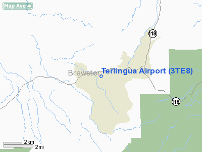
Location & QuickFacts
| FAA Information Effective: | 2008-09-25 |
| Airport Identifier: | 3TE8 |
| Airport Status: | Operational |
| Longitude/Latitude: | 103-35-00.6660W/29-19-09.7100N
-103.583518/29.319364 (Estimated) |
| Elevation: | 2717 ft / 828.14 m (Surveyed) |
| Land: | 0 acres |
| From nearest city: | 2 nautical miles E of Terlingua /alpine/, TX |
| Location: | Brewster County, TX |
| Magnetic Variation: | 09E (1985) |
Owner & Manager
| Ownership: | Privately owned |
| Owner: | Charles Fulcher |
| Address: | P.o. Box 602
Terlingua, TX 79852 |
| Phone number: | 915-371-2696 |
| Manager: | Charles Fulcher |
| Address: | P.o. Box 602
Terlingua, TX 79852 |
| Phone number: | 915-371-2696 |
Airport Operations and Facilities
| Airport Use: | Private |
| Wind indicator: | Yes |
| Segmented Circle: | No |
| Control Tower: | No |
| Landing fee charge: | No |
| Sectional chart: | El Paso |
| Region: | ASW - Southwest |
| Boundary ARTCC: | ZAB - Albuquerque |
| Tie-in FSS: | SJT - San Angelo |
| FSS on Airport: | No |
| FSS Toll Free: | 1-800-WX-BRIEF |
Airport Services
| Airframe Repair: | NONE |
| Power Plant Repair: | NONE |
| Bottled Oxygen: | NONE |
| Bulk Oxygen: | NONE |
Runway Information
Runway 13/31
| Dimension: | 3600 x 120 ft / 1097.3 x 36.6 m |
| Surface: | GRAVEL, |
| |
Runway 13 |
Runway 31 |
| Traffic Pattern: | Left | Left |
|
Radio Navigation Aids
| ID |
Type |
Name |
Ch |
Freq |
Var |
Dist |
Remarks
- RWY 13/31--SEVERE EROSION SOUTH END OF RWY.
Images and information placed above are from
http://www.airport-data.com/airport/3TE8/
We thank them for the data!
| General Info
|
| Country |
United States
|
| State |
TEXAS
|
| FAA ID |
3TE8
|
| Latitude |
29-19-09.710N
|
| Longitude |
103-35-00.666W
|
| Elevation |
2717 feet
|
| Near City |
TERLINGUA /ALPINE/
|
We don't guarantee the information is fresh and accurate. The data may
be wrong or outdated.
For more up-to-date information please refer to other sources.
|
|


