 |
|
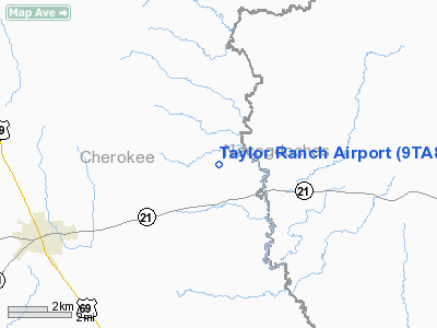
Location & QuickFacts
| FAA Information Effective: | 2008-09-25 |
| Airport Identifier: | 9TA8 |
| Airport Status: | Operational |
| Longitude/Latitude: | 094-58-37.7800W/31-41-02.6400N
-94.977161/31.684067 (Estimated) |
| Elevation: | 270 ft / 82.30 m (Estimated) |
| Land: | 73 acres |
| From nearest city: | 7 nautical miles E of Alto, TX |
| Location: | Cherokee County, TX |
| Magnetic Variation: | 05E (1990) |
Owner & Manager
| Ownership: | Privately owned |
| Owner: | Carl L Taylor |
| Address: | Po Box 304
Humble, TX 77347-0304 |
| Phone number: | 713-540-1662 |
| Manager: | Carl L Taylor |
| Address: | Po Box 304
Humble, TX 77347-0304 |
| Phone number: | 713-540-1662 |
Airport Operations and Facilities
| Airport Use: | Private |
| Segmented Circle: | No |
| Control Tower: | No |
| Sectional chart: | Houston |
| Region: | ASW - Southwest |
| Boundary ARTCC: | ZFW - Fort Worth |
| Tie-in FSS: | FTW - Fort Worth |
| FSS on Airport: | No |
| FSS Phone: | 817-541-3474 |
| FSS Toll Free: | 1-800-WX-BRIEF |
Runway Information
Runway 15/33
| Dimension: | 2000 x 60 ft / 609.6 x 18.3 m |
| Surface: | TURF, |
| |
Runway 15 |
Runway 33 |
| Traffic Pattern: | Left | Left |
|
Radio Navigation Aids
| ID |
Type |
Name |
Ch |
Freq |
Var |
Dist |
| GXD | NDB | Nacogdoches | | 391.00 | 05E | 14.1 nm |
| JSO | NDB | Cherokee County | | 263.00 | 05E | 16.5 nm |
| OC | NDB | Nados | | 253.00 | 05E | 17.8 nm |
| HNO | NDB | Henderson | | 371.00 | 06E | 30.9 nm |
| PSN | NDB | Palestine | | 375.00 | 04E | 37.5 nm |
| CZJ | NDB | Amason | | 341.00 | 04E | 43.0 nm |
| RPF | NDB | Carthage | | 332.00 | 04E | 45.8 nm |
| FZT | VOR/DME | Frankston | 051X | 111.40 | 06E | 36.7 nm |
| TYR | VOR/DME | Tyler | 089X | 114.20 | 06E | 45.9 nm |
| LFK | VORTAC | Lufkin | 058X | 112.10 | 05E | 34.1 nm |
| GGG | VORTAC | Gregg County | 070X | 112.30 | 07E | 45.6 nm |
Images and information placed above are from
http://www.airport-data.com/airport/9TA8/
We thank them for the data!
| General Info
|
| Country |
United States
|
| State |
TEXAS
|
| FAA ID |
9TA8
|
| Latitude |
31-41-02.640N
|
| Longitude |
094-58-37.780W
|
| Elevation |
270 feet
|
| Near City |
ALTO
|
We don't guarantee the information is fresh and accurate. The data may
be wrong or outdated.
For more up-to-date information please refer to other sources.
|
|


