 |
|
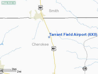
Location & QuickFacts
| FAA Information Effective: | 2008-09-25 |
| Airport Identifier: | 6X0 |
| Airport Status: | Operational |
| Longitude/Latitude: | 095-17-40.8200W/32-05-50.5780N
-95.294672/32.097383 (Estimated) |
| Elevation: | 590 ft / 179.83 m (Estimated) |
| Land: | 10 acres |
| From nearest city: | 2 nautical miles N of Mount Selman, TX |
| Location: | Cherokee County, TX |
| Magnetic Variation: | 06E (1985) |
Owner & Manager
| Ownership: | Privately owned |
| Owner: | Jim Tarrant |
| Address: | P.o. Box 286
Bullard, TX 75757 |
| Phone number: | 903-894-7246 |
| Manager: | Jim Tarrant |
| Address: | P O Box 398
Bullard, TX 75757 |
| Phone number: | 903-894-7246
EMERGENCY PHONE: 903-363-2651. |
Airport Operations and Facilities
| Airport Use: | Open to public |
| Wind indicator: | Yes |
| Segmented Circle: | No |
| Control Tower: | No |
| Landing fee charge: | No |
| Sectional chart: | Dallas-ft Worth |
| Region: | ASW - Southwest |
| Boundary ARTCC: | ZFW - Fort Worth |
| Tie-in FSS: | FTW - Fort Worth |
| FSS on Airport: | No |
| FSS Phone: | 817-541-3474 |
| FSS Toll Free: | 1-800-WX-BRIEF |
| NOTAMs Facility: | FTW (NOTAM-d service avaliable) |
Airport Communications
Airport Services
| Airframe Repair: | NONE |
| Power Plant Repair: | NONE |
Runway Information
Runway 12/30
| Dimension: | 2700 x 30 ft / 823.0 x 9.1 m |
| Surface: | TURF, Good Condition |
| |
Runway 12 |
Runway 30 |
| Traffic Pattern: | Left | Left |
| Obstruction: | 15 ft brush | 35 ft trees, 0.0 ft from runway |
|
Radio Navigation Aids
| ID |
Type |
Name |
Ch |
Freq |
Var |
Dist |
| JSO | NDB | Cherokee County | | 263.00 | 05E | 14.2 nm |
| TY | NDB | Tyler | | 320.00 | 06E | 21.1 nm |
| HNO | NDB | Henderson | | 371.00 | 06E | 22.7 nm |
| AHX | NDB | Athens | | 269.00 | 06E | 27.5 nm |
| PSN | NDB | Palestine | | 375.00 | 04E | 28.2 nm |
| ABG | NDB | Ambassador | | 404.00 | 07E | 30.8 nm |
| CSZ | NDB | Crossroads | | 215.00 | 08E | 33.8 nm |
| LIQ | NDB | Lochridge Ranch | | 335.00 | 09E | 33.9 nm |
| GXD | NDB | Nacogdoches | | 391.00 | 05E | 40.4 nm |
| OC | NDB | Nados | | 253.00 | 05E | 47.1 nm |
| PYF | NDB | Pyramid | | 418.00 | 06E | 48.1 nm |
| FZT | VOR/DME | Frankston | 051X | 111.40 | 06E | 12.1 nm |
| TYR | VOR/DME | Tyler | 089X | 114.20 | 06E | 16.5 nm |
| UIM | VOR/DME | Quitman | 087X | 114.00 | 08E | 47.2 nm |
| GGG | VORTAC | Gregg County | 070X | 112.30 | 07E | 33.6 nm |
| CQY | VORTAC | Cedar Creek | 095X | 114.80 | 06E | 47.3 nm |
Remarks
- 2049' MSL LGTD ANTENNA 2.75 MILES S OF ARPT.
- VFR ONLY; PROVIDED EACH RWY END IS MAINTAINED FOR A 20:1 APCH.
Images and information placed above are from
http://www.airport-data.com/airport/6X0/
We thank them for the data!
| General Info
|
| Country |
United States
|
| State |
TEXAS
|
| FAA ID |
6X0
|
| Latitude |
32-05-50.578N
|
| Longitude |
095-17-40.820W
|
| Elevation |
590 feet
|
| Near City |
MOUNT SELMAN
|
We don't guarantee the information is fresh and accurate. The data may
be wrong or outdated.
For more up-to-date information please refer to other sources.
|
|


