 |
|
Location & QuickFacts
| FAA Information Effective: | 2008-09-25 |
| Airport Identifier: | TX48 |
| Airport Status: | Operational |
| Longitude/Latitude: | 097-43-08.0000W/31-49-56.0000N
-97.718889/31.832222 (Estimated) |
| Elevation: | 880 ft / 268.22 m (Estimated) |
| Land: | 0 acres |
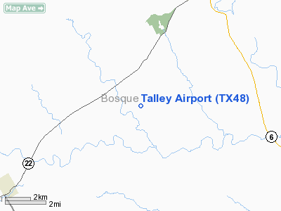
| From nearest city: | 8 nautical miles NW of Clifton, TX |
| Location: | Bosque County, TX |
| Magnetic Variation: | () |
Owner & Manager
| Ownership: | Privately owned |
| Owner: | John T. Talley |
| Address: | P. O. Box 249
Clifton, TX 76634 |
| Phone number: | 254-675-8330 |
| Manager: | John T. Talley |
| Address: | P. O. Box 249
Clifton, TX 76634 |
| Phone number: | 254-675-3771 |
Airport Operations and Facilities
| Airport Use: | Private |
| Wind indicator: | Yes |
| Control Tower: | No |
| Sectional chart: | San Antonio |
| Region: | ASW - Southwest |
| Boundary ARTCC: | ZFW - Fort Worth |
| Tie-in FSS: | FTW - Fort Worth |
| FSS Phone: | 817-541-3474 |
| FSS Toll Free: | 1-800-WX-BRIEF |
Runway Information
Runway 01/19
| Dimension: | 2418 x 100 ft / 737.0 x 30.5 m |
| Surface: | TURF, |
| |
Runway 01 |
Runway 19 |
| Traffic Pattern: | Left | Left |
|
Radio Navigation Aids
| ID |
Type |
Name |
Ch |
Freq |
Var |
Dist |
| MNZ | NDB | Hamilton | | 251.00 | 07E | 25.4 nm |
| ROB | NDB | Robinson | | 400.00 | 07E | 38.6 nm |
| GR | NDB | Starn | | 323.00 | 07E | 40.8 nm |
| HLR | NDB | Hood | | 347.00 | 07E | 42.3 nm |
| IL | NDB | Iresh | | 278.00 | 07E | 48.6 nm |
| TPL | VOR/DME | Temple | 041X | 110.40 | 09E | 40.4 nm |
| GRK | VOR/DME | Gray | 055X | 111.80 | 07E | 48.3 nm |
| JEN | VORTAC | Glen Rose | 097X | 115.00 | 06E | 21.3 nm |
| ACT | VORTAC | Waco | 100X | 115.30 | 09E | 25.2 nm |
| LZZ | VORTAC | Lampasas | 072X | 112.50 | 08E | 44.5 nm |
Remarks
- 613 FT TWR 2.5 NM N OF ARPT.
- PRVDD VFR OPNS AND CLEAR 20:1 APCHS.
Images and information placed above are from
http://www.airport-data.com/airport/TX48/
We thank them for the data!
| General Info
|
| Country |
United States
|
| State |
TEXAS
|
| FAA ID |
TX48
|
| Latitude |
32-55-00.453N
|
| Longitude |
097-11-01.047W
|
| Elevation |
780 feet
|
| Near City |
COLLEYVILLE
|
We don't guarantee the information is fresh and accurate. The data may
be wrong or outdated.
For more up-to-date information please refer to other sources.
|
|


