 |
|
Location & QuickFacts
| FAA Information Effective: | 2008-09-25 |
| Airport Identifier: | 00TA |
| Airport Status: | Operational |
| Longitude/Latitude: | 097-18-21.0000W/32-49-37.0000N
-97.305833/32.826944 (Estimated) |
| Elevation: | 598 ft / 182.27 m (Estimated) |
| Land: | 0 acres |
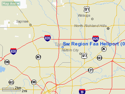
| From nearest city: | 5 nautical miles NE of Fort Worth, TX |
| Location: | Tarrant County, TX |
| Magnetic Variation: | 07E (1990) |
Owner & Manager
| Ownership: | Publicly owned |
| Owner: | Federal Aviation Admin
LEASEE. OWNER - AMCOT PARTNERS P O BOX 7006 FT WORTH TX 76111. |
| Address: | 2601 Meacham Boulevard
Fort Worth, TX 76173-4298 |
| Phone number: | 817-222-4300 |
| Manager: | Bob Cook Asw-50 |
| Address: | 2601 Meacham Boulevard
Fort Worth, TX 76173-4298 |
| Phone number: | 817-222-4350 |
Airport Operations and Facilities
| Airport Use: | Private |
| Wind indicator: | Yes |
| Segmented Circle: | No |
| Control Tower: | No |
| Lighting Schedule: | PHONE REQ
FOR PERIMETER LGTS CALL 817-222-5006. |
| Sectional chart: | San Antonio |
| Region: | ASW - Southwest |
| Boundary ARTCC: | ZFW - Fort Worth |
| Tie-in FSS: | FTW - Fort Worth |
| FSS on Airport: | No |
| FSS Phone: | 817-541-3474 |
| FSS Toll Free: | 1-800-WX-BRIEF |
Runway Information
Helipad H1
| Dimension: | 85 x 85 ft / 25.9 x 25.9 m |
| Surface: | CONC, Good Condition |
| |
Runway H1 |
Runway |
| Traffic Pattern: | Left | Left |
|
Radio Navigation Aids
| ID |
Type |
Name |
Ch |
Freq |
Var |
Dist |
| XQH | NDB | Cedar Hill | | 353.00 | 08E | 21.9 nm |
| RBD | NDB | Redbird | | 287.00 | 06E | 23.8 nm |
| LNC | NDB | Lancaster | | 239.00 | 06E | 33.1 nm |
| MWL | NDB | Mineral Wells | | 266.00 | 06E | 38.0 nm |
| PQF | NDB | Mesquite | | 248.00 | 06E | 39.2 nm |
| JUG | NDB | Jecca | | 388.00 | 06E | 40.3 nm |
| NFW | TACAN | Nas Jrb Fort Worth | 024X | | 07E | 7.5 nm |
| TTT | VOR/DME | Maverick | 078X | 113.10 | 06E | 13.6 nm |
| CVE | VOR/DME | Cowboy | 109X | 116.20 | 06E | 20.6 nm |
| FUZ | VORTAC | Ranger | 104X | 115.70 | 06E | 7.4 nm |
| MQP | VORTAC | Millsap | 124X | 117.70 | 09E | 35.5 nm |
| JEN | VORTAC | Glen Rose | 097X | 115.00 | 06E | 49.5 nm |
| UKW | VORTAC | Bowie | 071X | 112.40 | 06E | 49.9 nm |
| FTW | VOT | Fort Worth Meacham | | 108.20 | | 2.7 nm |
| DAL | VOT | Dallas Love Field | | 113.30 | | 23.0 nm |
Remarks
- CONCRETE PARKING AVAILABLE 50 FT X 210 FT.
Images and information placed above are from
http://www.airport-data.com/airport/00TA/
We thank them for the data!
| General Info
|
| Country |
United States
|
| State |
TEXAS
|
| FAA ID |
00TA
|
| Latitude |
32-49-37.000N
|
| Longitude |
097-18-21.000W
|
| Elevation |
598 feet
|
| Near City |
FORT WORTH
|
We don't guarantee the information is fresh and accurate. The data may
be wrong or outdated.
For more up-to-date information please refer to other sources.
|
|


