 |
|
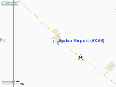
Location & QuickFacts
| FAA Information Effective: | 2008-09-25 |
| Airport Identifier: | 9XS6 |
| Airport Status: | Operational |
| Longitude/Latitude: | 102-31-19.7030W/34-03-11.3140N
-102.522140/34.053143 (Estimated) |
| Elevation: | 3769 ft / 1148.79 m (Surveyed) |
| Land: | 177 acres |
| From nearest city: | 1 nautical miles S of Sudan, TX |
| Location: | Lamb County, TX |
| Magnetic Variation: | 09E (1985) |
Owner & Manager
| Ownership: | Publicly owned |
| Owner: | City Of Sudan |
| Address: | Po Box 59
Sudan, TX 79371 |
| Phone number: | 806-227-2112 |
| Manager: | Glenn Cardwell |
| Address: | Box 513
Sudan, TX 79371 |
| Phone number: | 806-227-2252 |
Airport Operations and Facilities
| Airport Use: | Private |
| Wind indicator: | Yes |
| Segmented Circle: | No |
| Control Tower: | No |
| Landing fee charge: | No |
| Sectional chart: | Albuquerque |
| Region: | ASW - Southwest |
| Boundary ARTCC: | ZFW - Fort Worth |
| Tie-in FSS: | FTW - Fort Worth |
| FSS on Airport: | No |
| FSS Phone: | 817-541-3474 |
| FSS Toll Free: | 1-800-WX-BRIEF |
Airport Services
| Fuel available: | 100LL
FUEL AVBL FOR EMERG ONLY: CALL 806-227-2252. |
| Airframe Repair: | NONE |
| Power Plant Repair: | NONE |
Runway Information
Runway 04/22
| Dimension: | 2900 x 20 ft / 883.9 x 6.1 m |
| Surface: | ASPH, Fair Condition |
| Weight Limit: | Single wheel: 12500 lbs. |
| |
Runway 04 |
Runway 22 |
| Traffic Pattern: | Left | Left |
| Obstruction: | , 50:1 slope to clear | 15 ft road, 200.0 ft from runway
+35' PLINE AT THR 105' R; +3' FENCE 137' FM THR 38' R; ROAD 100-200' FM THR. |
|
Radio Navigation Aids
| ID |
Type |
Name |
Ch |
Freq |
Var |
Dist |
| LIU | NDB | Littlefield | | 212.00 | 10E | 10.5 nm |
| LLN | NDB | Levelland | | 266.00 | 09E | 30.8 nm |
| PRZ | NDB | Portales | | 407.00 | 09E | 44.4 nm |
| HRX | NDB | Hereford | | 341.00 | 09E | 49.3 nm |
| CVS | TACAN | Cannon | 053X | | 10E | 44.4 nm |
| PVW | VOR/DME | Plainview | 076X | 112.90 | 11E | 36.5 nm |
| TXO | VORTAC | Texico | 059X | 112.20 | 11E | 30.9 nm |
| LBB | VORTAC | Lubbock | 029X | 109.20 | 11E | 36.9 nm |
Images and information placed above are from
http://www.airport-data.com/airport/9XS6/
We thank them for the data!
| General Info
|
| Country |
United States
|
| State |
TEXAS
|
| FAA ID |
9XS6
|
| Latitude |
34-03-11.314N
|
| Longitude |
102-31-19.703W
|
| Elevation |
3769 feet
|
| Near City |
SUDAN
|
We don't guarantee the information is fresh and accurate. The data may
be wrong or outdated.
For more up-to-date information please refer to other sources.
|
|


