 |
|
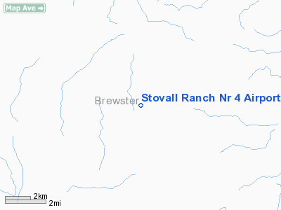
Stovall Ranch Nr 4 Airport |
Location & QuickFacts
| FAA Information Effective: | 2008-09-25 |
| Airport Identifier: | 6TX9 |
| Airport Status: | Operational |
| Longitude/Latitude: | 102-47-29.5620W/29-51-17.6880N
-102.791545/29.854913 (Estimated) |
| Elevation: | 3010 ft / 917.45 m (Estimated) |
| Land: | 0 acres |
| From nearest city: | 32 nautical miles SE of Marathon, TX |
| Location: | Brewster County, TX |
| Magnetic Variation: | 09E (1985) |
Owner & Manager
| Ownership: | Privately owned |
| Owner: | Guy F. Stovall, Jr. |
| Address: | Box 906
El Campo, TX 77437 |
| Phone number: | 409-543-3812 |
| Manager: | Eric M. Stovall |
| Address: | Box 185
Marathon, TX 79842 |
| Phone number: | 915-345-6713 |
Airport Operations and Facilities
| Airport Use: | Private |
| Wind indicator: | Yes |
| Segmented Circle: | No |
| Control Tower: | No |
| Landing fee charge: | No |
| Sectional chart: | San Antonio |
| Region: | ASW - Southwest |
| Boundary ARTCC: | ZAB - Albuquerque |
| Tie-in FSS: | SJT - San Angelo |
| FSS on Airport: | No |
| FSS Toll Free: | 1-800-WX-BRIEF |
Runway Information
Runway 01/19
| Dimension: | 5000 x 60 ft / 1524.0 x 18.3 m |
| Surface: | DIRT-TRTD, |
| |
Runway 01 |
Runway 19 |
| Traffic Pattern: | Left | Left |
|
Radio Navigation Aids
| ID |
Type |
Name |
Ch |
Freq |
Var |
Dist |
| IMP | NDB | Marathon | | 388.00 | 10E | 33.8 nm |
Remarks
- HORSESHOE MESA 4085' IS 2 MILES WEST OF THIS AIRSTRIP.
- WATCH FOR LIVESTOCK AND/OR MULE DEER ON ARPT.
Images and information placed above are from
http://www.airport-data.com/airport/6TX9/
We thank them for the data!
| General Info
|
| Country |
United States
|
| State |
TEXAS
|
| FAA ID |
6TX9
|
| Latitude |
29-51-17.688N
|
| Longitude |
102-47-29.562W
|
| Elevation |
3010 feet
|
| Near City |
MARATHON
|
We don't guarantee the information is fresh and accurate. The data may
be wrong or outdated.
For more up-to-date information please refer to other sources.
|
|


